
R.EARTH
Geospatial and farm design platform built on decades of field experience.
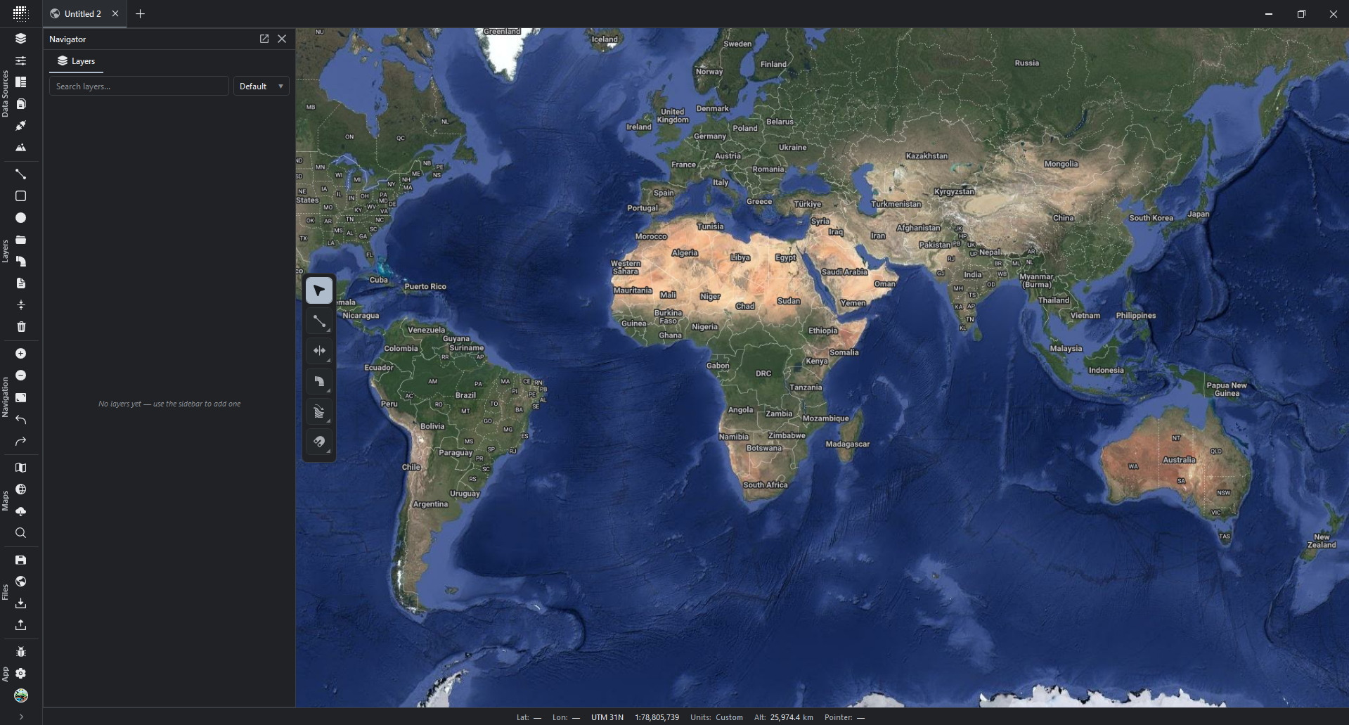
The tool we wish we had years ago.

Speed
Highly optimized. GPU accelerated. Lean and responsive.

Non-Destructive Workflow
Parametric toolkit with on the fly adjustments that keeps a project live until export.

Regrarians Base Maps
Curated list of powerful basemaps at your fingertips.
Terrain Awareness
Tools read the underlying terrain as you work, providing live statistics.
Pipe Networks
Concept and detailed pipe network systems over real terrain.

CAD
Overpowered and intuitive CAD tools.

Bill of Quantities
Project wide bill of quantities for pipe systems.

Watershed Analysis
Catchment, runoff, and storms analysis with live statistics.

Data Sources
Download high-resolution elevation data directly from the app. Connect to WMS/WMTS data sources.

Agroforestry
Tools for designing complex agroforestry systems.

Earthworks
Roads, channels, dams, and other earthworks made simple.

Fence Networks
Design electric fence networks with intricate control and live statistics.
Integrated Environment.
R.EARTH replaces the patchwork of CAD drawings, Google Earth and QGIS files, plugins, Excel spreadsheets and more.
Speed
We spend the majority of the development focused on optimizing the application for performance and efficiency through stress testing and real-world project work. This rigorous and time consuming process allows us to identify friction in the workflow as well as bottlenecks and limits to performance that we can then rethink, refine, and resolve. This endless feedback loop of constant testing and tinkering with the performance is at the foundation of the application.
Non-Destructive Workflow
Smart parametric tools are a core component of our application and enable non-destructive design and editing work, effectively creating 'living' projects that allow extensive changes to be done quickly and without losing hours of valuable work.
Regrarians Base Maps
Description pending
Terrain Awareness
Description pending
Pipe Networks
Description pending
CAD
Description pending
Bill of Quantities
Description pending
Watershed Analysis
Description pending
Data Sources
Description pending
Regrarians Platform
Effective planning is always based on organising frameworks which provide a solid and proven process to follow.
Curious where this is heading?
R.EARTH is in alpha stage. We are incrementally providing access to members of the Regrarians Workplace. If you are interested in joining, send us a message.
Alpha · 1.1.9 · October 2026