R.EARTH
R.EARTH RELEASE NOTES · UPDATED 10 AUGUST 2026

Changelog

No releases match that search.
1.0.5 2026-08-10 Current
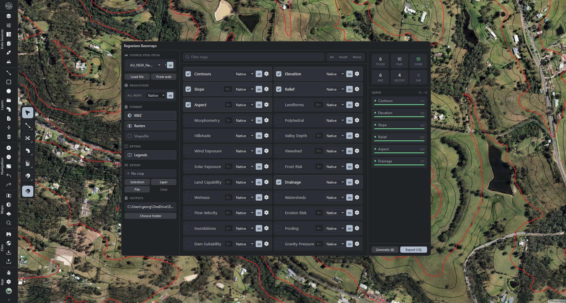
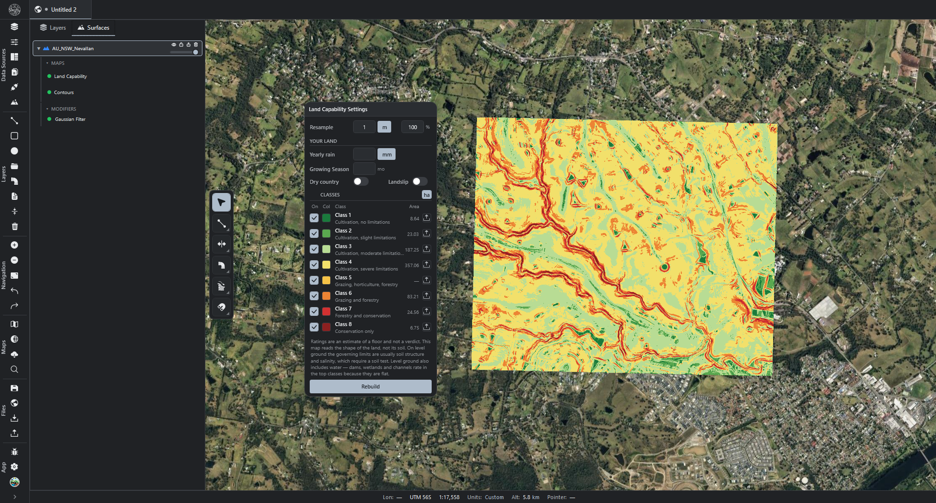
Regrarians Basemaps7
  • A set-once output folder. Exports are written there, sorted into a folder per format.
  • Map settings for Drainage and Watersheds are now available from the panel.
  • Elevation files may be loaded into the project directly from the panel.
  • One resolution and one format selection apply to every map. An individual map may override the resolution.
  • Contour interval and denoise read in metres or feet, cycled from the Contours settings.
  • Export states the number of files it will write, rather than the number of maps ticked.
  • Export writes files only. Maps are added to the project by Generate alone.
Drawing3
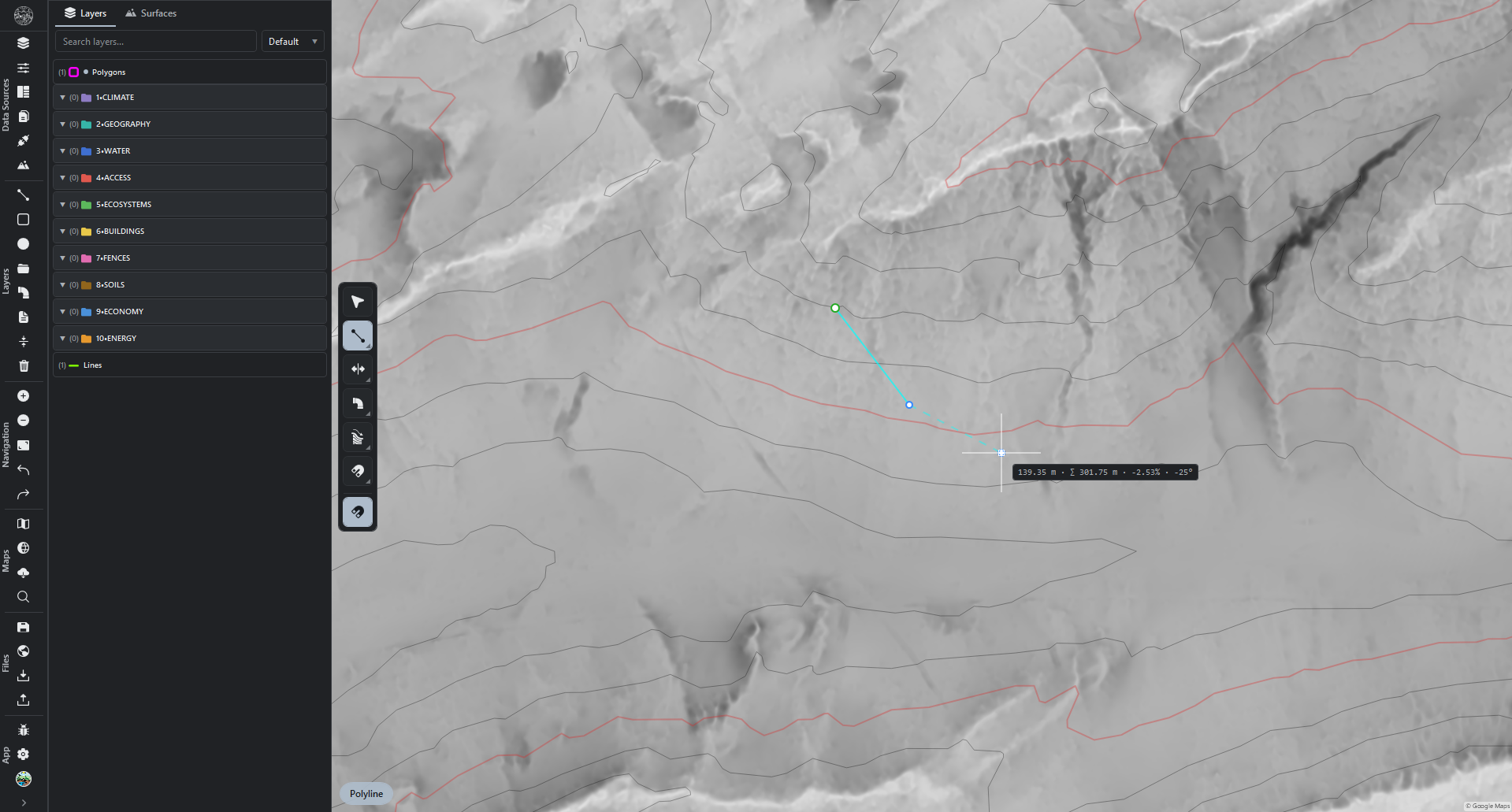
  • The cursor box carries the line's total length alongside the stretch in progress.
    • Each reading may be switched off on its own in Settings → Drawing → Cursor readouts.
    • With both off, the box remains for typing a length.
  • Slope of the stretch in progress, shown while drawing over an elevation map.
    • Plus for uphill, minus for downhill.
    • U cycles percent, degrees and a one-in-so-many ratio; percent to start.
    • Blank where no elevation map lies beneath the line.
    • The Pipe Network tool shows it as well.
    • Switched off in Settings → Drawing → Cursor readouts.
  • Kilometres and miles join metres and feet when cycling the drawing unit with U.
    • The same four apply to a grabbed vertex.
    • Elevation heights and map resolutions keep their own metres-and-feet setting.
    • A feet preference in Settings → Units still starts the drawing readout in feet.
1.0.4 2026-08-06
Pipe Network32
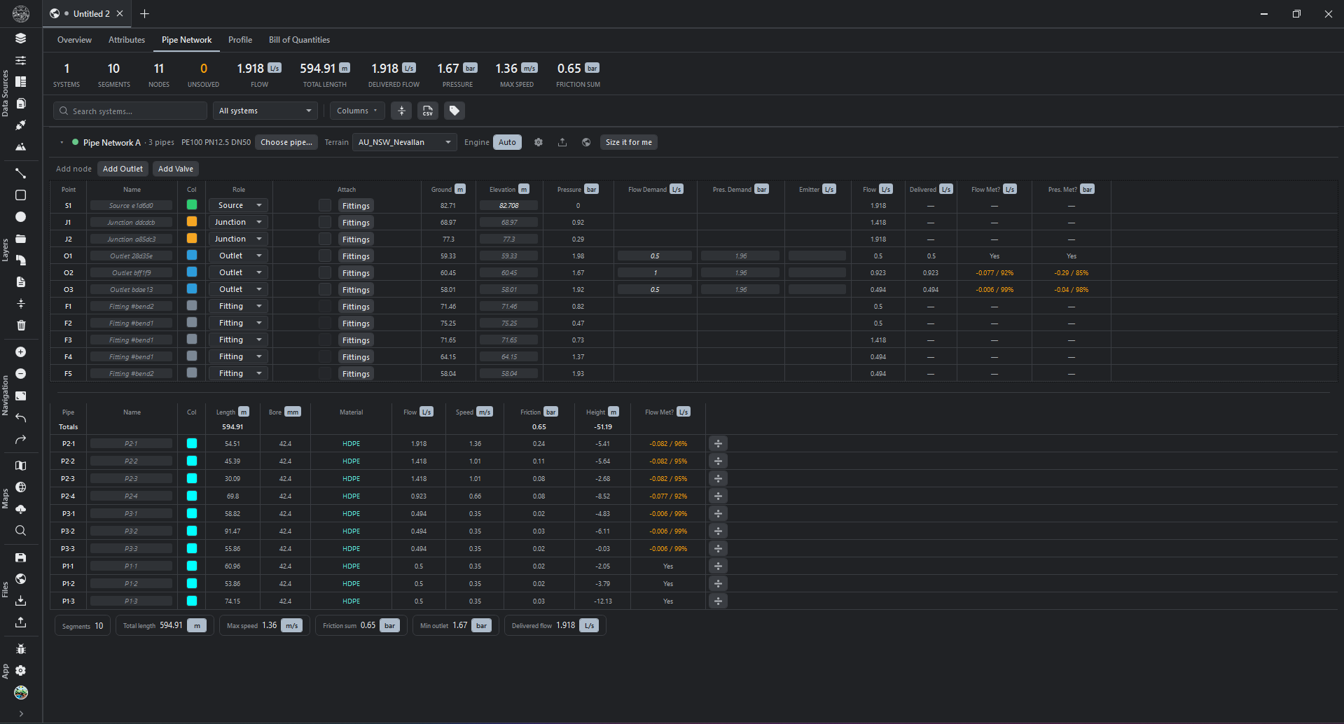
  • Every pipe stretch can be its own size. A single drawn pipe can now carry a different bore and material on each stretch. Click a stretch to select just that stretch; both design engines, the tables, export and save all honour it.
  • Subdivide from every pipe row. The Subdivide button now shows on every pipe row (not only on hover), plus a batch Subdivide button for several selected pipes at once.
  • Name individual pipe stretches and fittings — a label, maker, size or part number that leaves every other fitting of the same catalogue type untouched.
  • Add fittings at a fixed interval along a run, not only at bends.
  • Type each outlet's own required pressure directly in the Pipe Network table, instead of one figure for the whole run.
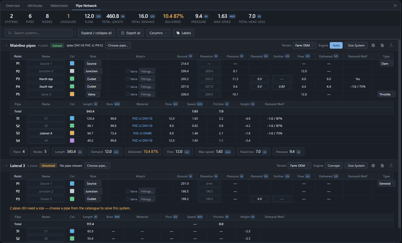
  • Two new verdict columns on the Pipe Network tab.
    • Whether an outlet got the pressure it needed.
    • Whether a pipe stretch delivers everything downstream of it.
  • The Pipe Network tab names the next thing needed to finish a run, and points at where to set it.
    • In order: ground, pipe size, an outlet, then a demand.
    • Turn the pointer off, or adjust it, from Settings → Theme → Appearance.
  • Pipe lengths follow the terrain. A run across sloping ground measures longer than the distance across the map.
    • Pressure results, the bill of quantities and pipe sizing all reflect the longer run.
    • The reading while drawing shows the pipe length, with the map distance alongside.
    • A typed segment cap limits each stretch to that length of pipe.
    • Interval labels along a pipe count pipe length.
    • Settings → Drawing → Pipe network switches the drawing readout to map distance.
  • The Pipe Network and Bill of Quantities tabs now match. Both put the summary totals at the very top with the numbers centred above their labels, share the same search box, and use the same compact icon-only toolbar buttons.
  • Drag any table column to resize it by its right-hand edge, on both the point and pipe tables.
  • Selecting a pipe or point row in the Pipe Network tab now highlights it on the map; clicking empty map space clears the selection.
  • Dragging a point on a pipe network updates pressure and checks live, on both the map and the tables, before you release.
  • The Vel. and Bore columns in the Pipe Network table now show a clickable unit, like the others.
  • Zone, Pump and Type start hidden on the Pipe Network table; bring them back from the Columns menu.
  • Delivered flow now reflects the pressure actually available, rather than always showing the amount asked for.
  • The Panorama panel no longer jumps or resizes while you draw pipes.
  • Pipe sizing accounts for the highest pressure a run carries. A pipe dipping through a gully is rated for it.
  • Bend and fitting losses are charged accurately. A shallow bend costs less pressure than a sharp elbow.
  • Routes crossing gaps in elevation data are flagged. Affected lengths are reported as a minimum.
  • Time-based (24-hour) pipe simulations now check every hour, not just the busiest one, for delivered water and burst or vacuum risk.
  • An outlet turned off, or on a schedule, no longer counts toward pressure and flow results as if it were fully open.
  • Extended-period (time-based) design settings now save and reload with the project.
  • A pipe's pressure and energy readout is no longer mirrored depending on which end it was drawn from.
  • Pipe network checks now judge each outlet against its own required pressure, not one figure for the whole system.
  • A source's ground level now actually affects the pressure results, not only the number shown on screen.
  • Some pipe runs were missing their pressure and flow figures entirely; they are now included in every check and reading.
  • The Columns menu on the Pipe Network table can bring a hidden column back, not only hide one.
  • A source starts at the ground beneath it.
  • Colours apply as soon as they are chosen — pipes, points, fittings and valves.
  • Each stretch of a pipe gets its own row in the Pipe Network and Profile tables.
  • A fitting with no catalogue part carries a sensible pressure loss.
  • A mid-run point only offers roles it can be, so choosing one no longer removes it.
Bill of Quantities9
  • A Bill of Quantities tab. A detailed, grouped list of everything your pipe networks are built from — pipes, valves, fittings and tank sources — organised by network and by system, with columns for item, material, bore, class, length and quantity. A pipe counts by its length, not as a single item.
  • The bill speaks metric or imperial per column. Click the unit on the Bore and Length columns to switch that column between millimetres and inches, or metres and feet.
  • Open the real maker's page for a part. Each fitting row has an Open button that goes straight to the manufacturer's own product page (Philmac, Kiwitech), never a third-party search.
  • Bill of Quantities reports order lengths and offcut. Set a pipe's bought-in length (for example 6 m sticks) and the bill states how many lengths to order and what is left over.
  • Work the Bill of Quantities, not just read it. Changes show on the Pipe Network and Profile too.
    • Pipes: click a stretch's material, bore or class to pick from the catalogue.
    • Fittings: click a fitting's type to change which part it is.
    • Valves: choose what the valve does, and its setting.
    • Sources: choose a tank's pump from the pump catalogue.
    • Name any component on the bill; the name shows everywhere and is saved.
  • Every bend is a real fitting you can order.
    • Give a drawn corner a catalogue part, and it appears in the bill and the Profile.
    • A fitting's part can also be changed from the Profile's Fittings tab.
  • Fittings now show up in the bill. Couplings created by subdividing or bending a pipe were being skipped, so the Fittings count read zero; they are all counted now.
  • Selecting a row in the bill now highlights it on the list and on the map, including click, Ctrl-click and Shift-click.
  • The Add-a-fitting picker no longer crops the Open link at the right edge, and hides the Part column where it does not apply.
Pipe Network Profile3
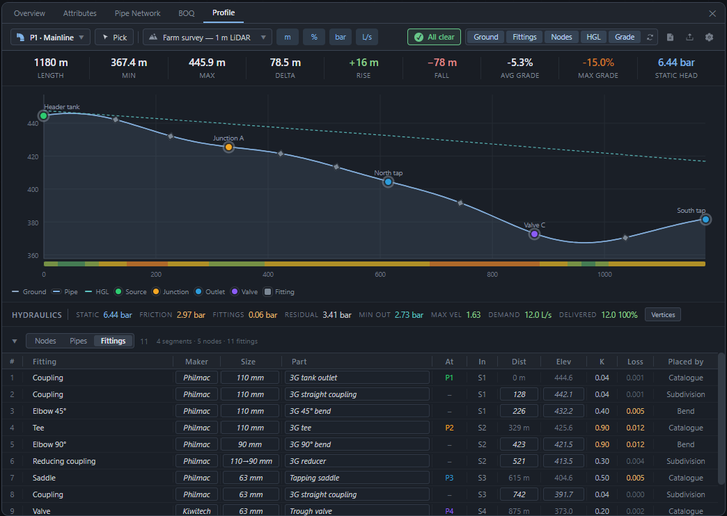
  • A Pipe Network Profile tab. A ground-following elevation cross-section of any drawn line or pipe run.
    • Shows the pipe's own grade line and hydraulic energy line drawn against the ground.
    • Drag a point on the chart; pressure and checks update live before you let go.
    • The map marks the spot under the chart cursor; chart selections light the map.
    • A synced table lists every point — distance, elevation, role, fittings, required pressure, flow — editable and sortable, with bulk edit across a selection.
    • One checks indicator per kind of problem, with detail shown only when something needs attention.
    • Choose which elevation map the profile is measured against; export the chart as an image.
    • Metric and imperial units throughout.
  • Recolour the Profile's legend.
    • Click ground, pipe, energy line, source, junction or outlet to set its colour.
    • The map uses the same colours, and they save with the project.
  • A stretch renamed in the Profile keeps its name.
Terrain maps6
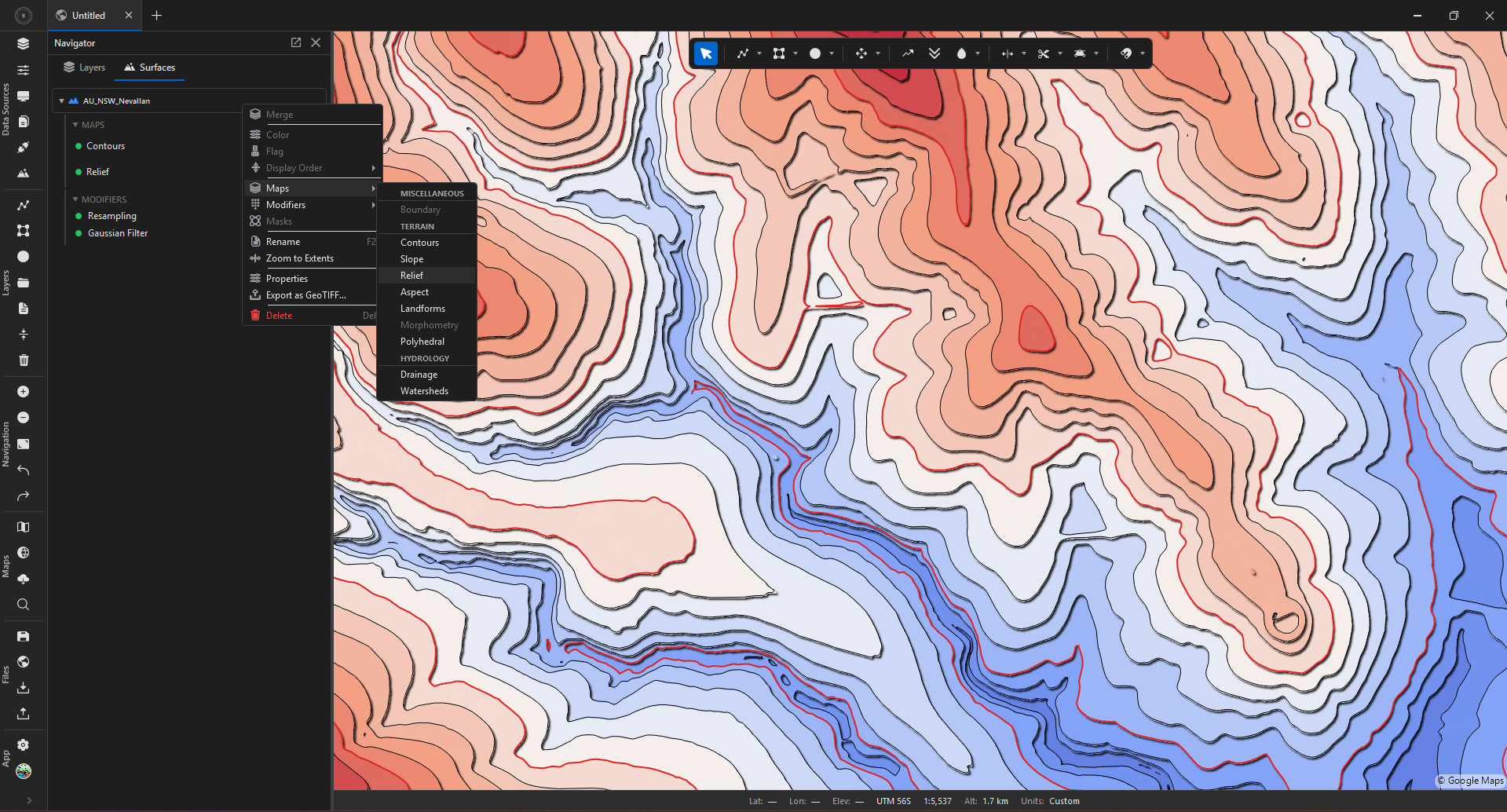
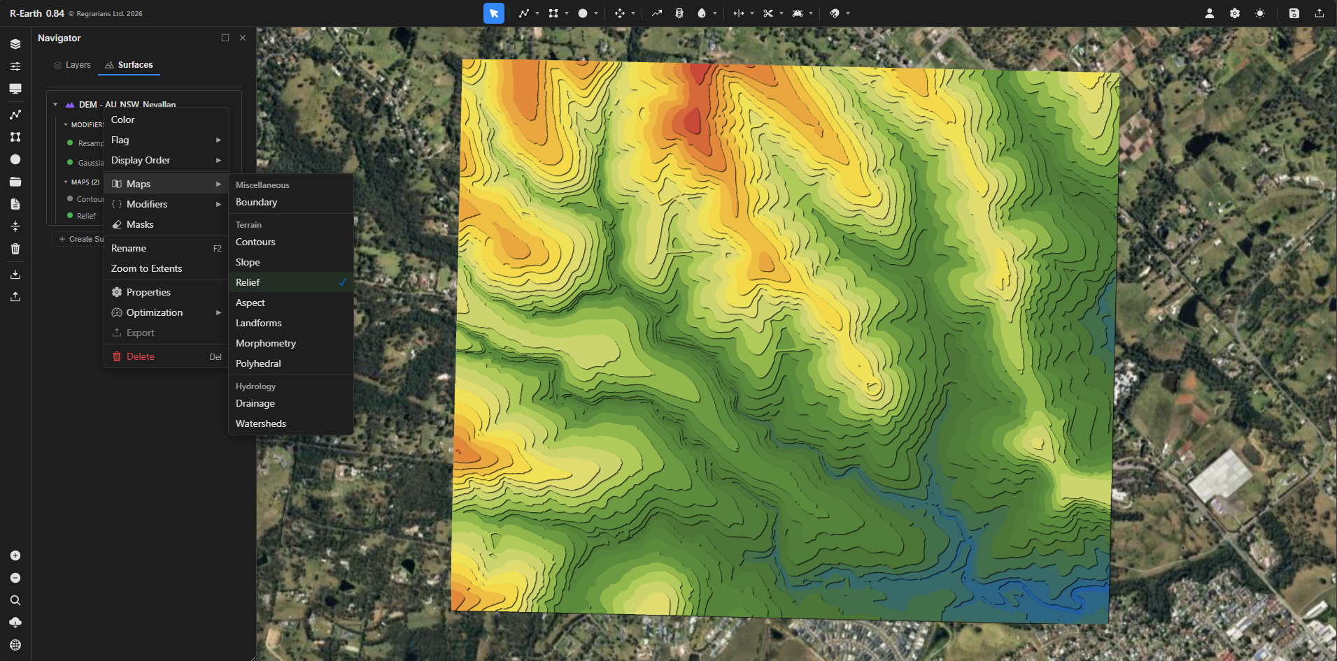
  • A new "Elevation" terrain colour map with nine palettes, brightness and sun-shading, and a height range that auto-fits or can be pinned for comparing sites.
  • A new "Wind Exposure" terrain map. Shows which ground the wind reaches and which sits in shelter.
    • Exposure may be shown for all directions, or for one wind named by where it blows from.
    • The look-ahead distance is adjustable, in metres or feet.
    • Six colour schemes, including Terrain, Atlas and Plasma, with an invert option.
    • A legend shows the colour range against the map's own values.
    • Several compass directions may be ticked to export one file each.
  • Changing the terrain colour map's palette, brightness, sun angle or height range updates the picture immediately.
  • More accurate slope readings, especially near the map's edge, around gaps in the elevation data, and away from the equator.
  • Contour clean-up now measures true ground distance, so short scrap pieces are removed correctly everywhere on the map.
  • Committing a mask trims the elevation map to the masked area.
Drainage2
  • Drainage: adding an order now adds detail. The stream-order plus and minus is now the level-of-detail control — more orders means a finer, denser channel network with a new smaller order appearing each time. The separate density field is gone.
  • Drainage colours are now stark and distinct. Each order gets a bright, clearly different colour (red, blue, green, orange, purple, cyan, and so on); a newly added order always takes a colour none of the others use.
Projects and recovery9
  • Saving a heavy project is now much faster, including the automatic background save.
  • The "Restore unsaved changes?" prompt is reserved for unexpected endings. A close made deliberately starts clean next time.
    • After a crash, forced shut-down or power cut, unsaved work is still offered back.
  • Restored work counts as unsaved, so closing without touching it still prompts to save.
  • Signing out clears every leftover recovery file, across all open projects.
  • Reclaims disk space left by sessions that ended abruptly. Real recovery files are never touched.
  • Switching between open project tabs no longer leaves stale drawings, numbers, or cached terrain from another project behind.
  • Quitting the app while a save is still finishing can no longer corrupt the project file.
  • A previous session's recovered project is no longer offered for restore-or-discard before the app has fully started.
  • Repair, and rolling back to an older version, now reliably fetch the exact version needed.
Import and export4
  • Unchecking a tile in the elevation or orthophoto import list now hides its outline on the map; re-checking a tile brings its outline back.
  • The Resolution and Area columns in the elevation and orthophoto import tables now show a clickable unit you can cycle (metres/feet; square metres/square feet/hectares/acres), replacing the separate Units column.
  • Exported elevation maps are recognised as GeoTIFFs, carrying their position and coordinate system.
  • Browsing NOAA elevation data now shows the real error when it fails, instead of reporting no data available.
Interface7
  • A bigger, cleaner app icon. The dark square behind the globe mark is gone — the mark now sits on a clear background and is drawn about a fifth larger, so it reads better in the taskbar and the window corner.
  • The drawing toolbar can be placed anywhere and restyled. Settings → Interface.
    • Nine positions: the four corners, the four edge-middles, or free-floating.
    • Four looks: the row of buttons, or icon cards down the side, across, or named.
    • Position and look are chosen independently, so any pairing is allowed.
    • Cards group the tools, and each card wears the tool last used inside it.
    • Right-click a card to arm the tool it shows without opening its menu.
    • The toolbar keeps clear of docked panels and the status bar.
  • Give docked panels a gap and rounded corners so they sit off the window edge like floating cards. Settings → Interface → Panel edges.
    • Adjustable gap and corner rounding, with an optional soft shadow.
    • Off by default.
  • Hide the status bar from its own right-click menu, not only from Settings.
  • Floating panels and the main window keep a sensible minimum size, so toolbars no longer overflow when a window is shrunk too far.
  • Dragging or double-clicking empty space in the title bar now moves or maximizes the window, not just the tabs and buttons.
  • Clicking away from the layer search box, or pressing Escape, returns keyboard shortcuts to the map immediately.
Settings1
  • Settings can be exported, imported and reset. The three sidebar buttons now act.
    • An exported file is readable and hand-editable, and records the build that wrote it.
    • Import states plainly why a file was refused, and asks before replacing anything.
Shortcuts3
  • Grade Lock has a keyboard shortcut, X, which arms it and opens its settings.
  • Batch export moves to Ctrl+X, releasing the bare X for Grade Lock.
  • The snapping options open from the toolbar's Modes card, alongside Grade Lock.
1.0.3 2026-07-20
Pipe Network11
  • Subdivide a pipe into fixed lengths. Right-click a pipe (or a pipe layer) and choose Subdivide, or set a length while drawing, and the pipe breaks into that many metres (or feet) of stick with a fitting at every join. The length unit is cyclable.
  • Fittings — a new kind of point. Every bend you draw in a pipe becomes a fitting (an elbow joint) by default, and a fitting costs a little pressure. Turn this off in Settings, Drawing, Pipe network if you prefer.
  • A point can be more than one thing. Mark a junction or an outlet as also a fitting (for example a sprinkler sitting on a fitting).
  • Source types: Generic, Dam, Tank, and Well. Dams and tanks hold a volume that fills and drains for time-based design; a well is pumped. Set the type on each source.
  • A pump for each source. Every source can carry its own pump — a catalogue pump with a real curve, or a simple lift — so a low dam can pump up to a high tank that then gravity-feeds the field.
  • Multiple sources that feed each other. Build a low dam that pumps up to a high tank and gravity-feeds onward; the app automatically switches to the detailed simulation when the layout needs it and says why in plain words.
  • Generic Pipes catalogue tab. PVC, HDPE, and PE in every common size, not tied to any manufacturer, for quick concept work.
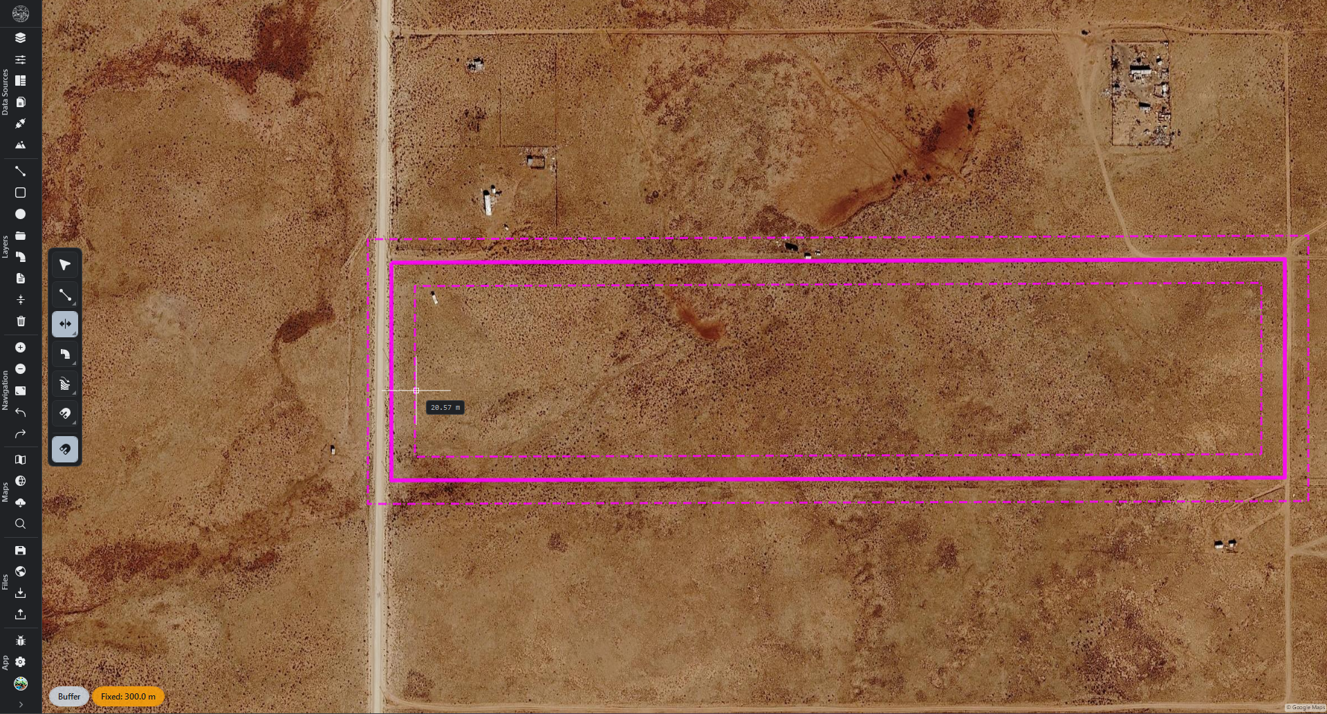
  • Draw pipes in set lengths. While drawing a pipe, type a length to cap each segment to it; type 0 or nothing for normal free drawing.
  • The Pipe Network tab is much more compact — tighter columns with nothing cropped, a clickable unit on every measured column and on the pump and system settings, and a Valve column that only appears when the network has valves. The pipe catalogue switches each column between metric and imperial.
  • The Pipe Network drawing tool uses the same on-screen dynamic input as the other drawing tools — the reading that follows your cursor.
  • Snapping a new pipe onto a fitting now makes a junction there, so the two pipes connect and the network solves instead of reporting an unreachable outlet.
Drawing tools2
  • Holding Shift while drawing now snaps to exact 5-degree steps, including after you have placed the first point.
  • The on-screen drawing readout now sits right at the cursor, returns to the live reading after you type a value, and a marker shows at both ends of the line while you draw.
Layout modifier1
  • Reshape a keyline main line per field, on the map (Layout modifier). Turn on Edit main line, drag the handles, and that field re-flows instantly.
Panorama1
  • The mouse wheel now scrolls the Panorama panel even when the pointer is over one of the tables.
Account1
  • Switch to a perpetual licence inside the app. In Profile, Upgrade to Perpetual now reveals an in-app form so you can redeem a perpetual code and flip over without signing out.
1.0.2 2026-07-20
Installation and repair2
  • Fixed an issue that could show "App files were modified" and stop the app from opening, even when nothing was wrong with your install. Your projects and sign-in were never at risk.
  • Added a one-click Repair. If that screen ever appears again, the new Repair button downloads the latest version and reinstalls it over your existing copy for you. Your saved projects and your sign-in are kept, and it updates your current install rather than adding a second copy.
1.0.1 2026-07-20
Pipe Network3
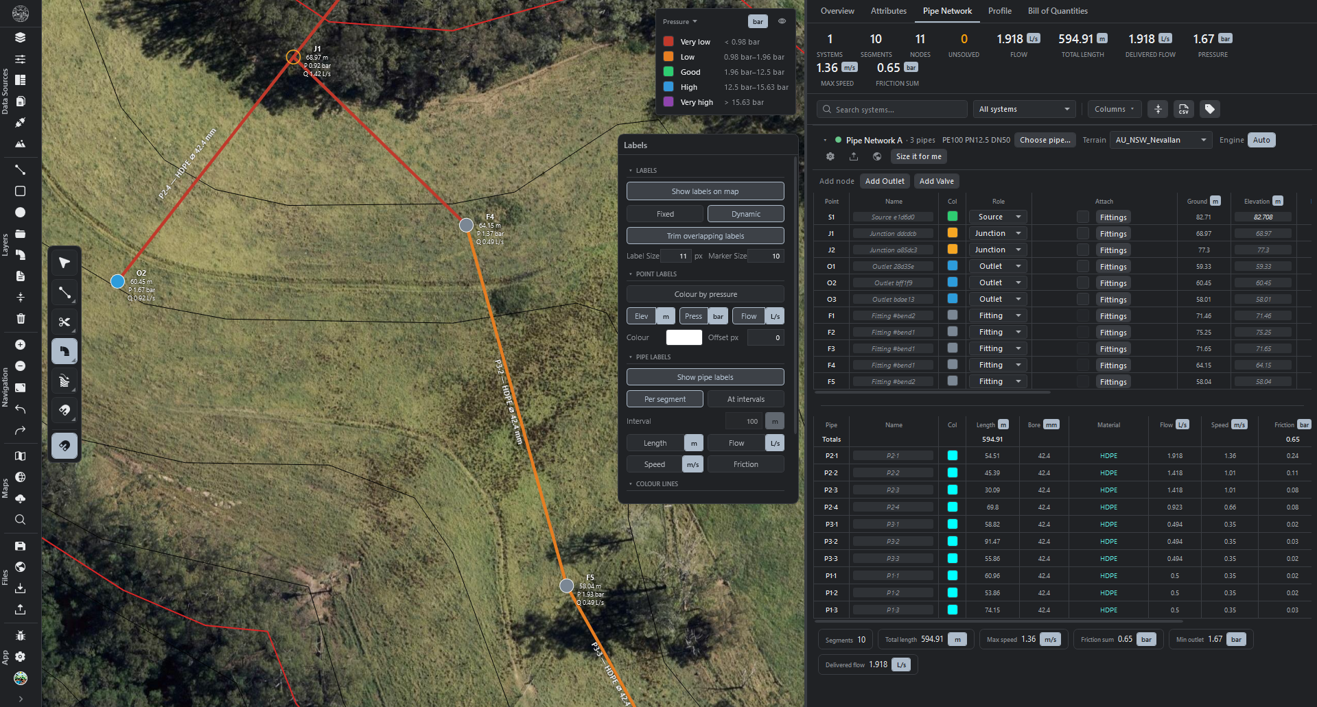
  • Pipe map labels scale with the map. Labels are now a real-world size, so they grow as you zoom in and shrink as you zoom out, staying constant relative to the network. Set the size in metres in the Map-labels popup, or switch to a fixed on-screen (pixel) size.
  • Trim overlapping pipe labels. A new toggle dissolves labels that would overlap, so a zoomed-out network stays readable instead of a pile-up. On by default.
  • Pipe flow reads in litres per second or gallons per minute. Pipe-network flow defaults to L/s on metric and gpm on imperial, and stays cyclable to other units.
1.0.0 2026-07-19
Pipe Network1
  • Pipe Network — design and size water networks over the terrain. Convert any open line into a pipe, then work the network from the new Pipes tab in the Panorama panel.
    • Convert: right-click an object or layer and choose Pipe Network; lines drawn on a pipe layer become pipes automatically.
    • Two modes: Concept (fast, the default) for quick layouts, and Detail for a full professional simulation. Switch per network.
    • Detail simulation adds: pump curves, pressure-based demand, multiple sources, looped networks, storage tanks, real valves (PRV, PSV, FCV, TCV), zones with scheduling, and time-based runs over a day.
    • Node roles: each point can be a source, outlet, junction, or valve; add an outlet or valve anywhere along a pipe.
    • Sizing: size pipes to hold a target pressure, or to deliver a target flow.
    • Catalogue: pick material and size from a built-in catalogue, assign to many pipes at once, or override any single pipe.
    • Pump catalogue: hundreds of pumps from real Australian and US manufacturers, searchable by maker.
    • Elevation per node taken from the elevation map beneath the network, with a manual override on any node.
    • Tables: a per-pipe table and a per-outlet table, with cyclable units and double-click rename.
    • On the map: node and pipe labels, an adjustable colour legend, and flow in litres per second, gallons per minute, or more.
    • Export the whole network to Google Earth (KMZ).
Labels3
  • Labels — per-object annotations drawn on the map at vertices. Toggle with F9 or from the Labels row in an object's or layer's right-click menu; one editor popup controls everything.
    • Elevation labels: each vertex's elevation, sampled from the terrain.
    • Slope labels: each segment's slope (percent, degrees, or ratio), with optional downhill flow arrows and slope-band colours.
    • Measurement labels: each segment's length and area.
    • Choose a fixed ground size or a zoom-based size; set each label type's side, offset, and stacked-or-inline layout.
  • Vertex elevation on hover. Hovering a vertex of a selected line or polygon shows its elevation in the status bar.
  • Slope labels and flow arrows always appear. They no longer stay hidden until the map is panned.
Panorama2
  • Bulk actions in the Panorama Overview. Multi-select rows in the Surfaces, Images, Maps, Modifiers, and Masks sections, then Hide, Reveal, Lock, Unlock, Export, or Delete them together. Deleting more than one asks first.
  • Find an attribute vertex on the map. Clicking a vertex row in the Panorama Attributes table marks that point on the map with a distinct cyan marker; clicking again clears it.
Elevation maps2
  • Deleting or hiding an elevation map can be undone.
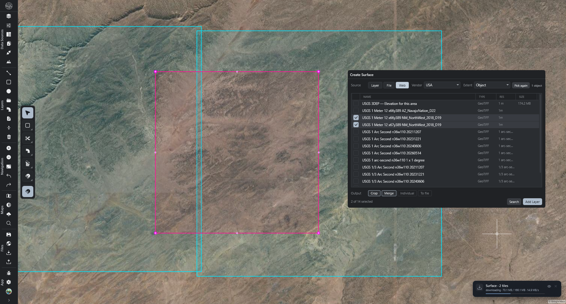
  • Create Surface over the United States returns data again. Building a surface from the web for a US area now finds elevation tiles reliably.
0.9.9 2026-07-15
Panorama1
  • Surface and image areas in the Overview panel. Each surface lists flat and true 3D area, and each photo its covered area, with empty regions excluded. Units are chosen per section.
Elevation maps2
  • Point elevation readout. A point placed over an elevation map shows its elevation in the Properties panel and the status bar.
  • More accurate slope readings. Slope values and labels follow gentle and changing grades more faithfully.
Orthophotos2
  • Orthophoto working copies clear on close. An imported photo's temporary on-disk copy is removed when the project closes, freeing disk; the photo rebuilds quickly when you reopen the project. Two on-by-default switches in Settings → Project control this for saved and unsaved projects.
  • Very large orthophotos are usable the moment they import. A big photo appears immediately and sharpens progressively to full detail, with the area you are working in sharpening first.
    • Tunable under Settings → Performance.
Drawing tools1
  • Circles draw, resize, and report correctly. Circle shapes stay visible, resize by dragging the rim, and show live diameter and area.
0.9.8 2026-07-14
Import6
  • See a photo's footprint before importing. The orthophoto import dialog outlines the file on the map and frames the view while open. Dropping several outlines each at once.
  • Crop extent outlined on the map. All five crop modes (Map View, Object, Layer, Draw, File) show the kept area for elevation files and orthophotos. It clears on Import or Cancel.
  • Import outlines hug the real data, not a bounding box. Elevation and orthophoto outlines now trace the true edge of valid data.
    • Skips the empty corners of a tilted photo, goes around interior holes, and draws separate outlines for separate patches.
    • A photo with no transparency shows a full rectangle.
    • After Import the outline holds as a placeholder until the first imagery paints, so there is no blank gap.
  • Big orthophoto import stays responsive. Dropping, previewing, and converting a large photo no longer makes the app sluggish or hitch. Conversion respects Settings → Performance → CPU and Memory.
  • Faster orthophoto conversion. Converting a photo is quicker, including a cropped import.
  • "Optimize" import control renamed and always available. Present for any file, off by default so a normal import is never shrunk, and switches on automatically for very large or very high-resolution files.
Interface4
  • Hide a running-job pill without stopping the work. An eye button hides one pill; the job finishes and its result still appears. still cancels, including on jobs that cannot be cancelled.
  • Tool-mode pills moved and made adjustable. The live tool-mode pills (Polyline, Offset, Trim, Transform, Fillet/Chamfer) now sit bottom-left in one themed colour family and stay clear of the panels and status bar.
    • Interface → Tool mode widgets → Position sets the corner.
    • Appearance → Tool mode widgets → Base color follows the theme accent or pins a colour.
  • On-map instruction bar follows the theme. The bar shown while drawing (import crop, Create Surface, drawing tools) now uses the neutral theme surface colour and stays clear of side panels.
  • App-wide stuck-drag and needs-a-second-click sweep. Several controls that could feel stuck after a drag was interrupted (Alt-Tab away, a menu opening, another control grabbing the mouse) now behave.
    • Floating panels and pop-out or welcome cards no longer glue to the cursor.
    • The snapping bar no longer jumps to the cursor on a plain hover.
    • The Selection tool no longer sticks (pan turning into a lasso, or a dead selection box eating the next click); the Layers-panel rubber-band select too.
    • The vertex editor no longer swallows your next map click when you change selection mid-edit.
    • Layer-row and Connections sub-row eye, lock, and delete buttons no longer ignore the first click.
    • Clicking a colour swatch a second time closes its picker instead of reopening it.
0.9.7 2026-07-14
Drawing tools3
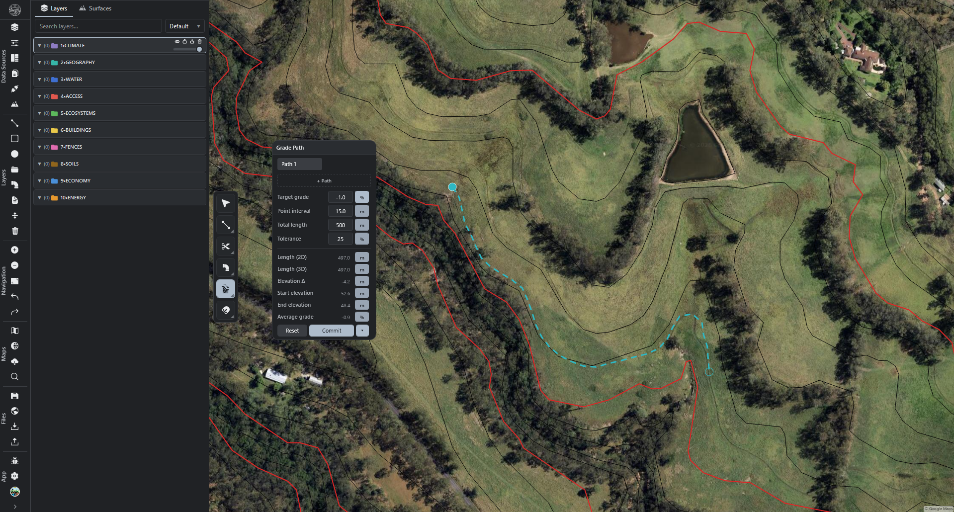
  • Grade Lock drawing tool. A toolbar tool, next to Snapping, that holds a line to a constant target slope over the terrain. With it on, the Polyline and Polygon tools and vertex dragging keep each point at the set grade.
    • Set the target grade and unit (percent, degrees, or ratio), the sideways search distance, and the minimum and maximum segment length.
    • A live label shows the current grade and segment length as you draw.
  • Grade Path clicks now snap. With snapping on, every click, including the first point, locks onto the nearest vertex, edge, or snap target under the cursor.
  • Slope readings are more accurate and steadier. A line at a steady grade reads close to that grade instead of jumping between segments.
0.9.6 2026-07-13
Projects2
  • Much faster saving for big projects. Projects with several large elevation maps or photos now save in a fraction of the time, and the automatic background save is lighter too.
  • Open and save projects with very large orthophotos (up to about 5 GB). Photos that were previously too large now import and save reliably. A new Settings limit sets the largest photo size the app accepts.
Drawing tools1
  • Floating tool labels no longer hide behind the bottom bar. The label shown while using the Polyline, Polygon, Offset, Trim, Fillet, or Transform tools always sits above the status bar.
0.9.5 2026-07-13
Drawing tools1
  • The Point tool now snaps. With snapping on, placing a point locks onto the nearest vertex, edge, or snap target, with a snap marker following the cursor, matching the Polyline and Polygon tools.
0.9.4 2026-07-13
Notifications2
  • Redesigned notifications. Pop-up messages and running-job pills are now one consistent card family in the bottom-right corner, newest at the bottom.
    • A small badge shows the kind of activity: import, map job, download, save, export, or message.
    • Colour appears only when something needs attention: amber for a warning, red for a failure.
    • Running jobs show a title, live progress, and a progress bar; a saved-file card offers "Click to show in Explorer".
  • Frosted-glass notifications (Frost theme). Notification cards can frost the map behind them. Settings → Appearance → Panel style — Glass has a new Notifications row with its own toggle and darkness control.
Import2
  • Orthophotos now use the full import dialog. Importing photos opens the same rich dialog as elevation files: a file table, "Merge into a single image layer", "Crop to extent", and an Optimize step. A single photo still appears immediately and sharpens moments later.
  • Area column and tidier controls on the elevation-import dialog. Each file shows its ground area; Merge and Optimize fold into one "Raster Processing" section; the five crop modes are highlighted buttons; "Clear crop" moved to the footer.
Panorama2
  • Panorama Overview rebuilt. The Overview tab is now flat, focused tables — Groups, Layers, Images, Surfaces, Maps, Modifiers, Masks — each with fitting columns, live counts, search, an All/Visible filter, per-section column pickers, and unit chips.
    • Values and the table align left, centre, or right; the controls column can be hidden; Resolution and Opacity can be typed into Map and Image cells.
    • Orthophotos and image layers have their own Images section; right-clicking a layer or group opens the Navigator's full menu.
  • Panorama Attributes rebuilt. The Attributes tab now has two modes.
    • From layers: each selected layer becomes its own table with geometry-appropriate columns.
    • From map selection: each selected object becomes one row per vertex — latitude, longitude, northing, easting, and the terrain elevation under each point.
    • Object rows are clickable (select, zoom, style, right-click menu), and each exports to Google Earth (KMZ) or attributes (CSV).
Interface2
  • Frosted-glass dropdown and right-click menus (Frost theme). Two new sliders in Settings → Appearance → Panel style — Glass set how see-through dropdown lists and right-click menus are, separately.
  • Floating panels size themselves smartly. Switching tabs in a floating panel fits the panel to the tab just opened. A hand-resized panel is remembered for the session and restored per project.
Export1
  • Export a single object from its right-click menu. Right-clicking an object offers Export File (Google Earth / KMZ) and Export Attributes (CSV) for just that object.
Navigator1
  • Drawing into a selected group keeps the new layer inside it. A line, polygon, point, Water Drop, or Grade Path created with a group selected lands inside that group. The Settings → Navigator Panel switch turns it off.
Offset modifier1
  • Offset rounding now rounds every corner and the original shape. With corner rounding on, every corner of every offset line rounds, and the original shape's corners round too.
0.9.3 2026-07-11
Navigator2
  • Resize the layer list with Ctrl and the mouse wheel. In the Navigator Layers tab, hold Ctrl and turn the wheel over the list to pack the rows tighter or looser, live.
  • New layers and groups land inside a selected group. With exactly one group selected, a new layer or sub-group drops inside it, at the top. A new Settings → Navigator Panel switch turns this off.
Interface2
  • Frosted glass on docked panels (Frost theme). Panels docked to a window edge can frost the map behind them, matching the floating panels.
  • Retuned the frosted-glass defaults. The Navigator panel reads a touch lighter and the Settings and sidebar surfaces a touch deeper.
Sign-in1
  • Login globe holds up over long sessions. The drifting clouds no longer smear across the globe, and the faint colour rings near the poles are gone.
0.9.2 2026-07-11
Sign-in1
  • Rotating-Earth login screen. Sign-in opens on a live 3D globe, with a real-time day/night terminator and cloud cover.
Interface2
  • Glass panel style (Frost theme). Panels can render as frosted glass: a blurred, tinted view of the map showing through.
    • Independent sliders for transparency, tint darkness, and blur strength.
    • Choose per surface (panels, headers, input fields, context menus) whether it goes glass or stays solid.
    • Settings → Theme, Frost theme only.
  • Visual refresh across the app. Restyled the terrain-map settings popups (Slope, Aspect, Landforms, Morphometry, Valley Depth, Drainage, Relief, Contours, Polyhedral, Watersheds), the modifier popups (Offset, Simplify, Fillet, Layout, Point Array, Mask), the Profile panel, checkboxes, and the Commit/Rebuild button.
Terrain maps1
  • Drainage map: Rebuild control. Gains the same Generate/Rebuild split button and auto-rebuild toggle as the other terrain maps.
Feedback1
  • Feedback submissions are never lost. A report that fails to reach the server is saved and retried automatically.
0.9.1 2026-07-10
Terrain maps2
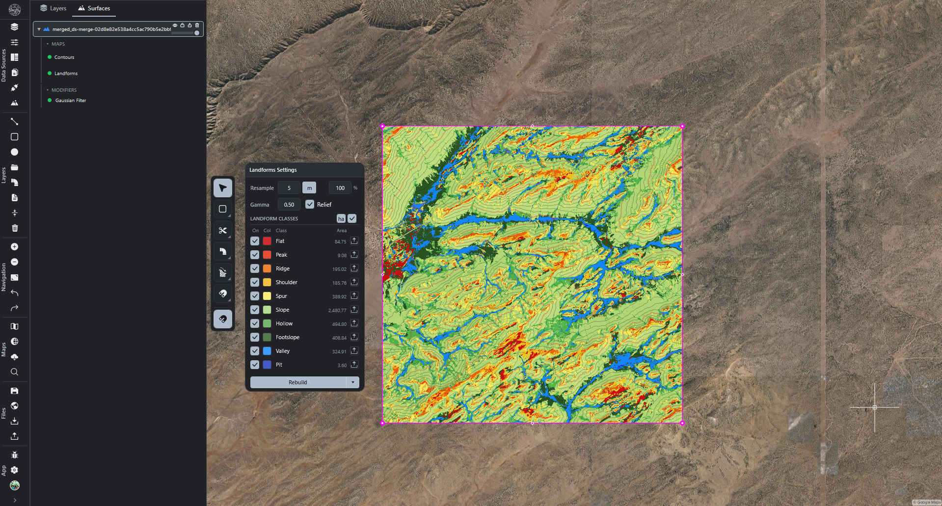
  • Valley Depth terrain map. A terrain map measuring, for every point, how far below the surrounding ridge lines the ground sits: valley floors read deep, ridge tops read zero.
    • Paints as a nine-step colour ramp, shallowest step transparent so flat ground shows the map beneath.
    • An optional relief blend shades the hillsides beneath the colours.
    • A settings popup controls the colour ramp, opacity, relief blend, and ridge detection.
    • Appears in the Maps menu and the Regrarians Basemaps panel, and exports to Google Earth (KMZ), GeoTIFF, and Range Maps.
  • Per-range area and export controls on the classified terrain-map popups. Slope, Aspect, Landforms, Morphometry, and Valley Depth share a consistent set of controls.
    • Area column: each range shows its ground area, with a header button cycling the unit (m² / ha / km² / acres).
    • Per-range export: each range exports on its own to Google Earth (KMZ), named after the site, map, and range.
Drawing tools1
  • Converting a filled area to a line produces a closed line. Converting or transferring a filled area onto a lines layer yields a properly closed outline.
0.9.0 2026-07-10
Measurements1
  • Style and size your measurement labels. The units Settings page is now "Units and Measurements". When length and area labels are shown (M), their colour, bold, drop shadow, and gap from the shape can be set.
    • Labels can size at a fixed on-screen size (pixels) that holds while zooming, or a real-world size (metres) pinned to the ground.
    • Choices apply live and are remembered.
Drawing tools1
  • Trimming and offsetting closed shapes now behave correctly. Offsetting a closed line produces closed lines that follow the original shape, and trimming a closed loop cleanly removes the swiped part and leaves one clean survivor, in every mode.
Projects and recovery1
  • More than forty additional ways work could be lost or the map go blank are closed. Further hardening of saving, opening, importing, undo, project restore, and working across several tabs. Trim notifications are also less noisy.
0.8.9 2026-07-09
Drawing tools1
  • The Trim tool was rebuilt to be dependable. Trimming a line against another shape, in any of its four modes, lands exactly where you swipe; a line that nothing crosses is never deleted by mistake; and locked or hidden layers still get cut when they should. Quick-fence trimming considers shapes across the whole area you drag.
Terrain maps1
  • Bigger elevation maps can use the graphics card. The amount of terrain the graphics card can handle at once is now much larger and adjustable with a slider, so larger maps stay on the fast path. A safety check stops a job that is too big before it starts.
Connections1
  • Downloading Portugal terrain works reliably again. The "Create Surface (Web)" download for Portugal's national terrain service works reliably and signs in again automatically when needed.
Projects and recovery2
  • Fifteen more ways work could be lost or the map go blank are closed. A further round of hardening across saving, opening, pasting between projects, terrain, orthophotos, modifiers, and multiple tabs.
  • More crashes from real-world use are fixed. Crashes and glitches around large-terrain contours, terrain popups, closing tools, layer rows, and nudging no longer happen.
0.8.8 2026-07-09
Projects and recovery6
  • Opening a project can never lose the one already open. If a project file fails to load partway through, the app keeps the current project fully intact and reports that the other file could not be opened.
  • A damaged project always opens now. A single unreadable piece (a terrain description, a generated shape, an image mask, a background-map setting, or a saved connection) can no longer stop the whole project from opening. The app keeps the good parts and warns about the piece it skipped.
  • A failed save can never wipe your data while claiming success. If one part of a save fails, the app leaves the saved file untouched and reports that the save did not finish.
  • Offsets, point arrays, terrain, and orthophotos survive every open and close. Generated shapes keep their full detail, damaged terrain and image data is preserved for recovery, and image edits (rotation, mask, resample) no longer revert.
  • Odd values no longer break a save. A stray invalid value in a shape, mask, or terrain summary can no longer make a save fail and drop that layer's edits.
  • Work always lands in the right tab. Background jobs, pasting between projects, and merging projects stay pinned to the tab that started them, even when you switch tabs.
Interface2
  • The map no longer goes blank while your layers are still there. Fixed cases where the map view went empty even though the layers held their data — after a graphics-driver hiccup, sleep or remote-desktop reconnect, a tab switch, an idle period, or an "include" mask hiding everything. The view recovers automatically and warns when a mask hides a whole layer.
  • The window always opens where you can see it. Fixed cases where the app or a floating panel (File Manager, Settings, or Profile) could open off-screen.
Account1
  • Gentler licensing. The app no longer shows an "expired" banner or locks the screen while it re-checks your licence. If a re-check ever requires signing out, your work is saved first. Offline use lasts longer, and a perpetual licence never signs you out.
0.8.7 2026-07-09
Projects and recovery7
  • Your work no longer disappears when saving. A single oversized elevation map, or one unreadable piece of data, can no longer make the entire save fail and roll back with every layer's edits.
  • Very large elevation maps save and reopen reliably. Big terrain grids that used to fail on save or refuse to open now work reliably.
  • Offsets, point arrays, and other generated shapes stay put. They are preserved across every open and close.
  • Orthophotos and images keep their pixels. Image layers retain their picture data even when it cannot be re-processed at the moment of saving.
  • Auto-save keeps going after a hiccup. A single failed automatic save no longer switches auto-save off for the session.
  • Stronger crash and shutdown protection. Every project with unsaved changes gets a recovery snapshot; recovery files are no longer deleted when a restore fails; and work is saved when Windows logs off or shuts down and when the app closes.
  • Saving always targets the right project. With several tabs open, a save can no longer write one project's contents into another's file.
Shortcuts1
  • Modifier and mask keyboard shortcuts. Press Shift plus a number key (1 to 5) to add modifiers and masks to the selected layer without opening the menu.
Feedback1
  • More helpful bug reports. Submitted feedback carries extra troubleshooting detail — your recent actions, your system and graphics information, and a session id. Project files are never included.
0.8.6 2026-07-05
Point Array modifier4
  • Point Array points are now fully editable. After you commit a Point Array, click any point to select it — a highlighted ring and a movable centre dot appear. Drag to reposition, or delete it like any other object.
  • Points appear instantly. Applying a Point Array scatters its points the moment you add it, and they keep updating live as you add or move shapes on the layer.
  • Commit no longer makes the modifier disappear. Committing bakes the points onto a new layer and tucks the original away, but the modifier stays live and editable. Turn the original layer's visibility back on and its points and settings return.
  • Old projects with a committed Point Array open correctly. They reopen live and editable instead of showing an empty, frozen modifier.
Projects and recovery2
  • Reliable copy and paste between projects. Copying whole layers between projects or tabs works consistently across elevation and surface maps, orthophotos, vector layers, groups, and images.
  • Faster project opening. Surface and elevation maps that were already calculated no longer re-run when you open a saved project.
0.8.5 2026-07-04
Navigator2
  • Fold everything at once. Shift-click the Expand/Collapse button to fold or unfold the modifiers, masks, and maps of every selected layer, group, and surface at once. A plain click still folds the groups themselves.
  • The Expand/Collapse All button works. The toolbar button that folds and unfolds all groups had no effect; it now does.
Projects and recovery5
  • Working with several projects at once. Project tabs gained keyboard shortcuts (open, close, switch), an unsaved-changes dot on each tab, and a tab strip that scrolls when crowded.
  • Open projects no longer bleed into each other. With more than one project open, photos, watershed and drainage layers, selection highlights, the side panels, and snapping all follow the tab you are looking at.
  • Long jobs land in the right project. Generating a terrain map, importing, or downloading finishes in the tab it started in, even if you switch tabs.
  • Tearing a tab into its own window no longer risks losing an unsaved project if the new window fails to open.
  • Silent data loss closed. Several ways a change could quietly fail to save — auto-saving an untitled project, reordering terrain maps, saving the wrong project across tabs, merging a partly-unreadable project, and importing an old web file with malformed shapes — now save correctly or tell you plainly what could not be read.
Updates1
  • Smoother updates. Installing an update no longer asks about desktop shortcuts and leaves a single clean "REarth" shortcut. The "Update Available" message lists every version's changes since the one you are on.
Settings1
  • Settings no longer crash the first time the panel is opened.
0.8.4 2026-07-04
Draw order2
  • Draw order control. Right-click any drawing, image, surface, or photo and choose "Display Order..." to open a popup of the whole map stack. Drag to move, use Front and Back, and reset any item to its default.
    • Each terrain map, photo, and image can be positioned independently.
    • Drawing layers are arranged relative to photos and terrain maps here; their order relative to each other stays in the Layers tab.
    • Every row shows the same icon and colour as the Layers and Surfaces tabs.
  • Contours above photos by default. Contours, drainage, and watershed maps draw above orthophotos by default, while shaded terrain maps stay below. Override this per item in Draw order.
Interface2
  • File Manager redesign. The file menu leads with recent projects and shows folder paths, unsaved and missing-file indicators, and timestamps, with a clear button on hover.
  • Window no longer jumps. Opening a previous project no longer flickers between minimised and maximised.
Performance4
  • Idle memory trimmer. When the app sits idle it can hand memory back to the system, keeping long sessions lighter. Controlled under Settings → Performance.
  • Large jobs no longer freeze the app. Deleting many layers or objects at once, copying and pasting many objects, duplicating, and deleting a large layer no longer stall the interface.
  • Large photo import no longer stalls. Importing large orthophotos keeps the interface responsive throughout.
  • Faster tab switching and layer lookups on projects with many layers.
Settings1
  • Settings search. Typing no longer freezes, and the typed text no longer stays stuck after the panel is closed.
Projects and recovery2
  • "No Layers Yet" on open. Opening a project that has layers no longer shows the empty-state message by mistake.
  • Older projects' contours render correctly again.
0.8.3 2026-07-03
Import3
  • Import area crop. Elevation and raster files can be cropped to a chosen area before import, reducing file size and processing time.
    • The crop area can come from the map view, selected objects, selected layers, a drawn shape, or a polygon file (.kmz, .kml, .shp).
    • On opening the dialog, the map frames the incoming data and outlines each file's true extent.
    • A preview of the selected area is shown before import.
  • Vector file import structure. Imported vector files reflect their own structure: a single-layer file imports as a layer with no enclosing group, while folders in the file become groups.
  • Large vector imports. Importing a large vector file completes without freezing.
Projects and recovery3
  • Copy and paste objects between projects. Ctrl+C and Ctrl+V copy selected shapes from one tab and paste them into another.
  • Deleted terrain maps stay deleted. Removing a generated terrain map fully removes it: it does not reappear when the project is reopened.
  • Faster project open. Projects with many generated terrain maps open faster.
Connections1
  • Masked credential fields. API keys and other secret values display as dots, with a toggle to reveal them.
Performance8
  • Performance settings. Under Settings → Performance: a cap on the processor cores watershed generation uses, level-of-detail tolerance controls, and an optional slow-operation timing readout.
  • Steady editing. Editing a project runs without the periodic multi-second pause and basemap flicker.
  • Watershed labels. Labels place without a pause on large or complex basins.
  • Faster watershed generation.
  • Responsive on large drawings. Snapping while drawing, hovering, Select All, and moving many objects at once stay responsive as a drawing grows.
  • Responsive masking. Applying and committing masks no longer freezes the app.
  • Faster startup. The application opens more quickly.
  • Smoother polygon rendering. Smoother panning and zooming on polygon-heavy maps.
Interface2
  • On-map guidance. A banner shows the current instruction while a tool such as crop is active.
  • Refreshed checkbox styling.
Modifiers5
  • Modifier context menus stay open. Adding a modifier from a right-click menu keeps the menu open so several can be added in succession; other items close on selection as before.
  • Slope overlays collapsed by default. The Flow Arrows and Slope Labels sections of the Slope modifier start collapsed.
  • Bulk modifier updates. Moving several modifier-bearing objects at once updates every selected object.
  • Offset direction. Offsetting a shape that was already offset follows the cursor instead of always moving inward.
  • Slope labels on curves. Labels thin out where they would overlap on tight curves. Hiding a layer or its Slope modifier hides the arrows and labels.
Masks2
  • Mask editor. Opening a mask begins drawing immediately, and a commit control applies the mask in place.
  • Mask outlines. Opening a mask's settings shows its region outlines immediately. Deleting a layer closes any open mask editor and clears its outlines.
0.8.2 2026-07-02
Navigator4
  • Multi-select layer context menu. Right-clicking two or more selected layers or groups opens a full action menu.
    • Icon, Style, Flag, Display Order, Zoom to Extents.
    • Commit: applies every selected layer's uncommitted modifiers at once.
    • Modifiers: adds a modifier to every selected layer at once; holding Shift links the new instances so their settings stay in sync.
    • Rename, Duplicate, Convert, Merge, Group Selected, Ungroup, Select All Objects, Export Files, Export Attributes, Save as Template, Delete.
    • A group-only section shows or hides, locks or unlocks, and expands or collapses every selected group.
  • Duplicate for layers, images, and groups. Duplicate makes a true independent copy of the layer, image, or group and its contents, from both menus.
  • Single Commit menu per layer. One Commit menu lists every uncommitted modifier on a layer alongside Commit All Modifiers.
  • Style listed above Icon. In the right-click menu for point, line, and polygon layers, Style now appears before Icon.
Modifiers1
  • Link modifiers. A modifier can be pasted onto another layer as a live link: adjusting a value on either side updates both, as one undo step. Geometry-specific settings, such as Point Array picks, stay independent.
Interface2
  • Refreshed icons across the toolbar and every context menu. New icons for Layout, Modifiers, Grade Path, Panorama, Convert, Fillet, Offset, Line, Polygon, Measure, Display Order, Sort, Flag, Style, and Icon.
  • Higher-contrast context-menu icons. Every context-menu icon now renders solid and brighter, matching the toolbar.
Changelog2
  • Changelog opens instantly. Settings → Changelog opens directly on the Changelog section.
  • Keyboard shortcuts highlighted in the changelog. Every shortcut named in a changelog entry is shown in the app's accent colour.
0.8.1 2026-07-01
Slope modifier1
  • Slope modifier — Flow Arrows and Slope Labels. Two independently-toggleable overlays.
    • Flow Arrows: downhill water-flow direction along each line, evenly spaced.
    • Slope Labels: each segment's slope value (percent, degrees, or ratio).
    • Both update live, sit on opposite sides of the line, and work with Offset, Layout, Fillet, and Simplify.
    • Size, spacing, and offset use ground units (m / ft / km / mi); colour is fixed or matched to the slope band.
    • Collapsible settings; both export to KMZ as two toggleable layers.
0.8.0 2026-07-01
Modifiers7
  • Modifier commit workflow. Modifiers may be committed to geometry through several actions.
    • Simplify modifier: a live Strength control (in metres) that reduces line detail with immediate feedback, plus its own Commit action.
    • Commit split-button: Simplify and Fillet each offer commit to a new layer (keeping the original) or commit in place.
    • Commit All Modifiers: a layer menu action that applies the combined output of a layer's modifiers to one new layer and hides the original.
  • Group-level Slope modifier. A Slope modifier can be applied to a group from the group menu.
    • It colours every applicable line across all layers in the group.
    • It updates as layers or shapes are added, and exports to KMZ for the whole group.
  • Default export folder for modifiers. Settings → Export provides a Modifiers auto-export folder and an auto-open-on-export option.
  • Slope-modifier KMZ export. Coloured segments in Google Earth show their average slope when selected, as positive percentages, with consistent naming (for example, RoadA_Slope).
  • Rendered geometry is authoritative. After a line is rounded with Fillet or thinned with Simplify, the resulting shape is used throughout.
    • Length, area, perimeter, grade, and slope readouts, GeoJSON export, and selection all follow the rendered line.
    • Reported vertex count continues to reflect the placed points.
  • Offset follows a simplified line. When a line is simplified and then offset, the offset copies trace the simplified shape. Fillet rounding stays excluded from the offset trace so offset corners are stable.
  • Duplicate outline on Fillet or Simplify. Selecting a line with a Fillet or Simplify modifier no longer renders the original line beneath the modified one.
Projects and recovery2
  • Multiple concurrent projects. Projects can be opened in separate tabs and switched instantly.
    • Each tab keeps a fully independent workspace: layers, terrain, modifiers, map view, undo/redo, and notifications are isolated per project.
    • A background tab's status messages do not appear on the active tab.
    • Content can be copied between tabs, including layers, objects, images, orthophotos, and terrain with their modifiers, maps, masks, styles, and settings.
    • Each tab displays its project name.
  • Save confirmation. Ctrl+S and Save reliably persist the project and show a "Project saved" confirmation that reveals the file when selected.
Connections2
  • New Zealand nationwide elevation (LINZ). Create Surface can source high-resolution elevation from Land Information New Zealand for the selected area.
    • The application orders the extract, awaits it, and imports it as standard terrain.
    • A user-supplied LINZ API key is required and is retained after first entry.
  • Elevation lookup from a selected shape. Creating a surface from a single object's outline returns elevation data.
Watersheds2
  • Batch generation of watershed runoff scenarios. The Watersheds tab provides a Generate Scenarios action.
    • It produces one scenario for every combination of the selected focus areas, storm durations, and return periods.
    • It retrieves the matching NOAA design-storm rainfall so precipitation, runoff, and peak values are populated automatically.
    • Output files are named by convention (for example, road_24hr_10y).
    • The dialog supports inline renaming and output as one file per scenario or a single combined file.
    • Each area's watershed may export as KMZ, with separate CSV and KMZ folders, each retained for next use.
    • The dialog is movable and resizable.
  • Local-drainage restriction for watersheds. A per-area Local drainage only option limits the uphill catchment at valley channels, so a side-hill feature such as a road does not acquire an overstated area.
Interface4
  • Group selection indicator. Selecting a shape on a layer within a group activates the group's selection indicator at every level.
  • Trim tool mode indicator. The Trim tool shows an on-screen mode indicator consistent with the other tools, updating as modes cycle with Ctrl.
  • Background map responsiveness. The satellite/web map keeps loading and redrawing while terrain maps compute or a project saves or opens.
  • Text selection and navigator scrollbar. Dragging across text in a field selects the text rather than moving the row, and the navigator scrollbar responds to dragging.
Import1
  • Preserved names when pasting from Google Earth. A pasted item keeps its Google Earth name and no longer creates an extra "Untitled" wrapper folder for a single item.
0.7.9 2026-06-29
Added5
  • Orthophoto context menu. Right-clicking an imported aerial image opens a menu tailored to images, without terrain-only entries.
  • Orthophoto masks. An orthophoto can carry the same non-destructive mask as a terrain surface.
    • Rectangles, circles, or freehand areas may be drawn, or an existing shape or whole layer reused.
    • Content is kept to only what is inside (Include) or cut out from inside (Exclude), with an optional feathered edge.
    • The original image is never altered: regions may be added, edited (including dragging corners), or removed at any time.
    • The mask is saved with the project.
  • Orthophoto resample control. A render-time Resample control trades detail against memory and speed for very large images.
  • Create Surface from an orthophoto footprint. An orthophoto's menu offers Create Surface, sourcing web elevation covering the image's own area.
  • Orthophoto import as merged or separate. When two or more aerial images are imported at once, a dialog offers to combine them or import them as separate layers.
Changed3
  • Press-M measurement labels redesigned. Length and area labels are shown as an overlay.
    • Monospaced font with a soft shadow and no bounding plate.
    • Each segment's label runs parallel to the line it measures, offset slightly so it does not sit on the line.
  • Drawing-angle reference. A Settings → Drawing toggle sets the live angle while drawing a line to read as the turn from the previous segment (the default) or as a bearing from north.
  • Orthophoto merge progress. Combining images shows a progress indicator.
Fixed2
  • Dismiss-click no longer starts drawing. Left-clicking empty map to close the map or object menu no longer begins a selection box or a new shape.
  • Polyline drawing corrections. Several minor line-drawing issues were resolved, including a stale hint that the next click would close the shape.
0.7.8 2026-06-29
Added8
  • Transfer a shape between layers with kind conversion. A selected shape has a Transfer action.
    • Move to Layer: relocates it to a different layer.
    • Copy to Layer: places a duplicate and keeps the original.
    • If the destination is a different kind of layer, the shape converts to match: a filled area onto a lines layer becomes a closed outline, and vice versa.
    • An open line cannot become an area, so that transfer is not offered.
  • Convert between lines and areas. A Convert entry, on both the object menu and the layer menu, rebuilds closed outlines as filled areas in a new layer, or the reverse, without altering the originals.
  • Mask transfer between surfaces. A mask can be copied from one terrain surface to another, or moved by holding Alt and dragging it between surfaces.
    • A status dot next to a surface shows whether its mask is active, paused, or absent.
  • Masks applied to modifier input. A Settings → Modifiers and Masks tab sets, per project, one of two behaviours.
    • Hide the modifier result beneath the masked-away area (the default).
    • Exclude the masked-away ground from the calculation so the modifier processes only the retained terrain.
  • Image merge. Overlapping orthophotos or imported images may be combined into a single merged image.
  • Terrain merge confirmation. Merging terrain surfaces shows a dialog confirming what will be combined first.
  • Mask from a shape. The object menu offers a mask action, letting a drawn shape become a surface's mask directly.
  • Point Array multi-shape sets. A Point Array set can gather several source shapes; re-picking a shape moves it between sets rather than restarting.
Changed4
  • Fillet across the closing seam. The Fillet tool rounds the corner where a closed shape's end meets its start, as well as the intermediate corners.
  • Closed-shape join corner. Dragging the single corner where a closed outline starts and finishes keeps the shape closed.
  • Modifier transfer re-targets geometry. Holding Alt and dragging a modifier onto a different surface re-targets it to that surface's own shapes.
  • Unified colour picker. A single colour picker is used throughout, and context menus provide flag and icon pickers.
Fixed4
  • Numeric entry in map setting popups. A number can be double-clicked to select it in full and replaced by typing, committing on Enter or on clicking away.
  • Modifier-row deletion. Clicking the delete button on a terrain map row deletes the row without opening its settings.
  • Multi-layer reorder. Dragging several selected layers to reorder them works reliably.
  • Arithmetic overflow on auto-save of large terrain. Importing a very large terrain no longer triggers an "Arithmetic overflow" error on auto-save.
0.7.7 2026-06-27
Added8
  • Offset tool Slide mode. The Offset tool provides a third mode alongside Single and Multiple: Slide.
    • Single and Multiple keep the original line and lay down offset copies; Slide moves the line itself and creates no copy.
    • Ctrl cycles the modes, or a mode may be picked from the tool's dropdown.
    • A slide is a single undo step, the moved line stays fully editable, and it can be offset again afterwards.
    • In normal distance mode a slide follows the cursor; in fixed-distance mode it moves by the exact distance.
  • Object context menu. Right-clicking a selected shape (or several) opens a dedicated menu.
    • Create Surface: web elevation covering the shape's exact outline.
    • Measurements: the press-M length and area labels.
    • Close / Open Line and Select Similar (every shape of the same kind on the same layer).
    • Transforms: Copy, Paste, Move, Rotate, Scale.
    • Maps: a terrain map, including a watershed focused on the selected shape.
    • Modifiers: Offset, Point Array, Layout, or Fillet on the shape's layer.
    • Object Style, Move to Layer, Duplicate, and Delete.
    • Entries that do not apply are greyed rather than hidden, and every item can be reordered or disabled in Settings → Context Menus.
  • Terrain masks. A terrain surface can carry a non-destructive mask.
    • Rectangles, circles, or freehand areas may be drawn, or an existing shape or whole layer reused.
    • Content is kept to only what is inside (Include) or cut out from inside (Exclude).
    • The underlying elevation is never altered: regions may be added, edited (including dragging corners), feathered, or removed at any time.
    • Every one of the surface's maps and its exports follow the mask.
    • Re-trimming after an edit is immediate.
  • Create Mask from the map. Right-clicking a terrain surface and selecting Create Mask opens that surface's mask editor with a cut-out rectangle ready to draw.
  • Object download area. In Create Surface web download, the area dropdown provides an Object choice.
    • One or more closed shapes may be selected, and the download follows their exact combined outline.
    • The elevation is cropped to that shape when crop-to-extent is enabled.
  • Per-object style. Object Style (on the object menu, or F8) gives one shape, or several of the same kind, its own colour and line style.
    • A "Switch to Layer Style" action reverts, and the style is saved with the project.
  • Morphometry terrain map. A valley-to-ridge map shading low valley floors through to high ridgelines, with adjustable banding, gamma, and opacity.
  • Basemaps panel redesign. The Regrarians Basemaps panel presents its maps as a grid.
    • A terrain file can be loaded for basemap work without adding it to the project.
    • Contour sets can be selected for export and styled in a popup, and every map can be resampled together.
Changed2
  • Per-category notification control. Settings → Notifications provides one switch per kind of message, and no category is permanently forced on.
  • Create Surface renamed. "Create Surface from Web" is labelled Create Surface on the object menu.
Fixed1
  • Inactive Settings controls. A Settings review reconnected several controls that had no effect and corrected two cases where a panel showed a stale value.
0.7.6 2026-06-24
Added1
  • Layer Hierarchy settings tab. Layers stack on the map to match the layer tree.
    • A layer above another in the tree appears above it on the map, and reordering takes effect immediately.
    • Settings → Layer Hierarchy sets, by kind of layer, which kinds sit on top of which, by dragging the rows.
    • The default places drawings on top, then contour lines, then orthophotos, then terrain maps.
    • A terrain surface's own maps keep their top-to-bottom order from the tree; the hierarchy sets only their position relative to other kinds.
    • New terrain map types appear in this list automatically.
Changed1
  • Progressive orthophoto detail. A newly imported orthophoto displays immediately at low detail and sharpens in stages, so work can begin before a large photo finishes converting.
Fixed1
  • "Background snapshot failed" error. Switching between tabs no longer produces a "Recent edits may not survive" message when a layer is removed at the same moment.
0.7.5 2026-06-24
Added8
  • Large orthophoto import (aerial and drone imagery). A georeferenced photo (GeoTIFF) dragged onto the map places itself in position automatically.
    • Large files stay responsive: panning and zooming a very large image stays smooth and light on memory.
    • A low-resolution preview appears first, then sharpens.
    • The full photo is saved inside the project file, so a single file carries everything.
    • A long import can be cancelled from the notification, and orthophoto layers export to Google Earth (KMZ).
  • Import of legacy web-app project files (.fpp). A project made in the earlier R.EARTH web application opens as a new desktop project.
    • It carries across drawn shapes, the layer tree, elevation grids and their terrain maps, and images.
    • Content that could not be imported is listed in a summary report.
  • Switzerland elevation source. Create Surface web download offers Switzerland at half-metre and two-metre detail.
    • An area over Switzerland or Liechtenstein sources the official swisstopo data and crops it to the drawn box at full detail, with no size cap.
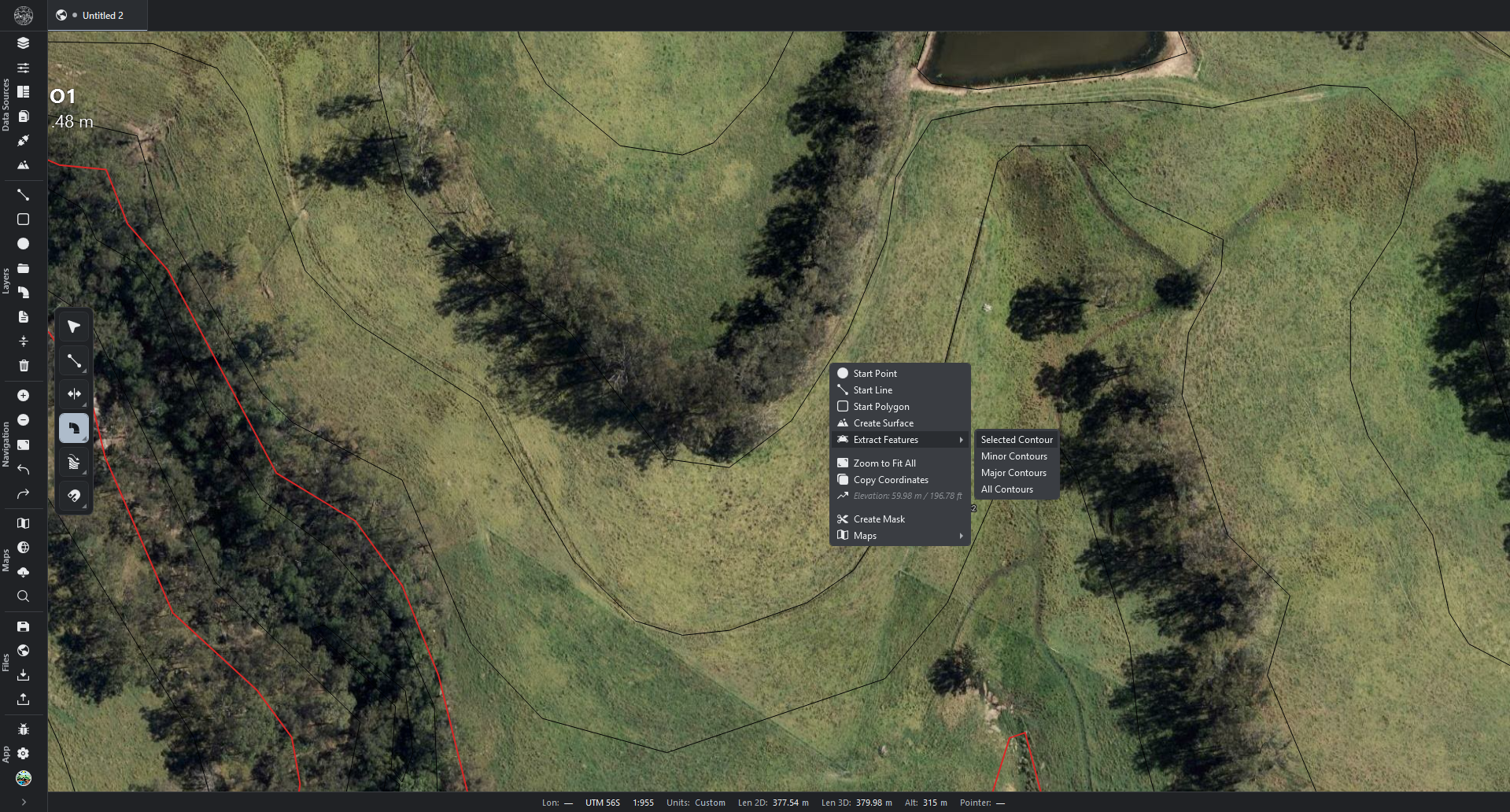
  • Extract Features to editable contour shapes. Right-clicking a terrain surface and selecting Extract FeaturesMinor Contours, Major Contours, or Both places the matching height lines into a new layer.
    • The lines become ordinary editable line objects that can be moved, restyled, deleted, or exported.
    • The surface and its on-screen contours are unaffected, and the operation is a single undo step.
  • Press-M selection measurement. Selecting one or more lines or shapes and pressing M annotates each segment with its length and the area at the centre of any closed shape.
    • Pressing M again clears the annotations, and while shown, U cycles the units.
    • The measurement is read-only.
  • Status Bar settings tab. The controls for the bottom status bar are grouped in their own Settings → Status Bar tab.
  • Context Menus settings tab. Settings → Context Menus enables or disables individual entries and reorders them by dragging, for all four menus.
    • Dividers are also draggable, and the configuration is reflected exactly in the live menus.
  • Orthophoto cache control in the Diagnostic panel. An "Orthophoto image cache" row reports the disk used, with its own Clear button, included in Clear-all. Clearing is safe: the copies rebuild on next open.
Changed3
  • Background export with progress and cancel. Google Earth (KMZ) export, terrain-map KMZ, Google Earth sync, terrain GeoTIFF, and batch exports run without blocking the application.
    • The map and cursor stay responsive, a progress bar is shown, and a long export can be cancelled.
  • Responsive imports. Imports keep the cursor and map responsive while a photo is converting.
  • Hectares as the default area unit. Areas default to hectares, suited to land and catchment work.
    • The Settings → Units list shows the actual unit each measurement uses (for example, "ha").
Fixed2
  • Offset distance entry. Typing a distance and pressing Enter applies the entered value rather than one carried over from an earlier operation.
  • Multi-line labels in Google Earth. Labels with more than one line are no longer collapsed into a single line in batch and Google Earth sync exports.
0.7.4 2026-06-23
Added3
  • Drawing settings tab. Settings → Drawing collects the live cursor readouts, the Shift snap angle, and the vertex-move behaviour, each toggled or adjusted.
  • Drawing-angle readout. Drawing a line shows the segment's compass bearing beside its length.
    • A length and angle may be typed together, for example 100,45.
  • Live length, angle, and area during vertex editing. Selecting a vertex shows the length and bearing of the segment running into it.
    • Typing a value sets that segment exactly.
    • Closed lines and polygons also show the enclosed area, updating as the vertex moves.
Changed3
  • Two-click vertex move. A vertex is picked up with one click, moved, and dropped with a second, without holding the button. Settings → Drawing restores press-and-drag.
  • Shift angle snap. Holding Shift snaps the segment to exact compass-bearing steps, with the step size set in Settings → Drawing.
  • Press-U unit cycling during vertex editing. Pressing U while editing a vertex cycles the units of both the length and the area.
0.7.3 2026-06-18
Added2
  • Keyline Multi-pattern. When enabled, the field is divided into smaller sub-areas, each with its own best-fit set of rows, so the pattern follows the land more closely.
    • The division method may be by drainage (Basin), by slope direction (Direction), or by best fit (Fit).
    • The number of pieces is chosen automatically or set manually.
  • Keyline Headlands. A clear band of any width may be left inside the field edge as a turning buffer for machinery.
    • With Multi-pattern enabled, that width becomes the gap between pieces, so neighbouring patterns sit side by side.
Changed4
  • Keyline Scenarios as a search-intensity control. A higher value directs a more thorough search for the best layout: raising it improves the result or leaves it unchanged, never worsening it, at the cost of more time.
  • Simplified Keyline settings. Every control is in one list — Interval, Scenarios, Target grade, Fillet, Simplicity, Min length — with no separate Advanced section.
    • Simplicity trades grade-holding against straighter, cleaner rows.
  • Fast dense line layouts at any zoom. Keyline, Contour, and Offset layouts with thousands of lines stay responsive during pan and zoom, before and after commit. Heavy line drawings move freely with no loss of detail.
  • Faster layout commit. Converting a dense layout into editable geometry no longer causes a long pause.
Fixed5
  • Exact contour spacing. Contour rows are never drawn closer than the minimum gap set.
  • Slope colouring on line and polygon layers. Slope colouring works on line and polygon layers, alone and with other modifiers such as Layout and Offset, updating live.
  • Immediate Layout redraw. Dragging any Layout slider updates the pattern immediately.
  • Responsive selection of heavy geometry. Selecting one very detailed line, or many at once, keeps panning responsive and the selection tracks the map cleanly.
  • Stray highlight after point editing. Dragging a vertex moves the highlight to follow the new shape.
0.7.2 2026-06-16
Media
Videos
0.7.2 · Overview

R.EARTH 0.7.2 — Full Overview

Complete walkthrough of the 0.7.2 release including watershed focus areas and water drop tool.

Add YouTube / Vimeo link
0.7.2 · Watersheds

Watershed Analysis — Focus Areas & Manual Mode

Multiple focus areas, per-area methods, and the new Manual watershed mode.

Add YouTube / Vimeo link
Screenshots
Default screen
Base maps
Surface maps
Grade Path
Layer stack
Properties
Offset tool
Added9
  • Per-area watershed tables. With several focus areas, each has its own table stacked down the panel, with its own headings and unit choices.
    • One area can display hectares and acre-feet while another displays different units.
  • Per-area calculation method. Each area can use its own method (Rational, NRCS, Annual Yield, or Basic Storm).
    • Its table shows only the columns that method requires.
    • The panel fits its width to whichever area needs the most room.
  • Manual watershed mode. Drawn or picked shapes each become a watershed with live area, slope, and runoff figures.
    • Manual and Focus modes are fully independent: each keeps its own areas, styles, labels, and statistics.
  • Spread and Channels per area. Each area can display its Spread and its Channels, each toggled per area.
    • Spread: the downhill ground its water can reach, with its own runoff statistics.
    • Channels: the flow lines leaving it.
  • Two design-storm runoff-volume methods.
    • Annual Yield: the average annual volume a site produces.
    • Rational (CN): the Rational peak with a curve-number volume estimate.
  • Watershed to editable shapes. A single action converts any sub-basin, a whole area, or the Spread zone into editable shapes in a new layer.
  • Combined data fetch. For US terrain, one button fetches every source the chosen method requires at once — NRCS soil groups, USDA land cover, and NOAA design storms. A notification shows while data is fetched.
  • Analysis Tools menu. The arrow next to the Analysis Tools button opens a list, with Water Drop at the top and selected by default.
  • Automatic elevation-source selection in Create Surface. On opening a web download, the regional elevation provider for the map's centre is pre-selected (USA, Australia, New Zealand, Finland, France, Spain, or Portugal). Another may be selected instead.
Changed7
  • Use Global Inputs follows the global inputs live. An area set to use global inputs displays and calculates with the current global values. Giving an area its own method lets it set its own values.
  • Inherited value shown in every input cell. Each area and sub-basin displays the number it inherits rather than a blank box.
    • An Apply button pushes the global inputs into every cell.
    • A fetch or apply action overrides any custom values entered.
  • Reordered method list. The order is Rational, Rational (CN), NRCS (CN), Basic Storm, Annual Yield.
    • Methods show only the columns they use: the Peak column is hidden for Annual Yield.
    • The Totals line omits a coefficient or impervious figure, which do not sum.
  • Metric / Imperial switch in the status bar. Shown by default, with hectares the default metric area unit.
  • Basic Storm method name. The "Generic" runoff method is named Basic Storm. The focus-area picker and text search share one Filter row.
  • Per-area method selection. The per-row method picker is removed; the Method column shows the method each area uses, set once per area.
  • Water Drop long drainage lines. A Water Drop click traces a line to the edge of the terrain, flooding through any hollow or basin in its path.
    • The line is smoothed into a clean channel rather than a jagged staircase.
    • Clicking a no-data gap begins at the nearest available ground.
Fixed2
  • Reliable US data fetching. Soil, land-cover, and storm lookups retry on failure and allow longer for slow government servers.
    • The soil lookup falls back to a point query when a large area would otherwise time out.
    • Precipitation is populated for any storm-based method, and the soil button no longer stays lit.
  • Watershed table alignment. Columns align under their headings even when some rows show a download button, and values are centred.
0.7.1 2026-06-14
Added5
  • Automatic NOAA storm and rainfall data. For US terrain the watershed tools fetch the official NOAA precipitation-frequency tables for the location.
    • A storm length and return frequency may be selected, and the rainfall figure is populated automatically.
    • The storm pattern (Type I, IA, II, or III) may also be selected.
  • Blended curve numbers and longest-flow-path column. A sub-basin's curve number is blended across its full mix of ground cover and soil.
    • The table includes an LFP column showing each sub-basin's longest drainage path, in metres or feet.
  • App-wide units. A Units area in Settings sets whether the whole application displays metric or imperial, with one-click presets and a quick switch in the status bar.
    • Watershed figures follow that choice immediately.
  • Bottom docking for the Panorama panel. A panel dragged to the bottom edge snaps into a band across the bottom, consistent with side docking. The panel sizes itself so its settings are not cut off.
  • Additional themes, toolbar size control, and persistent sign-in.
    • The drawing toolbar floats over the map.
    • A "remember me" sign-in keeps the session between launches.
Fixed3
  • Correct watershed catchments. Picking a road or line captures exactly the area that drains across it, rather than a narrow strip or the whole hillside. Soil and ground-cover data are populated automatically.
  • Self-contained installer. The application runs on any Windows machine with nothing else to install first.
  • Background save, settings popups, and tab tear-off.
    • Background save no longer warns without cause.
    • Settings popups stay in place when switching windows and cannot be dragged off-screen.
    • Tearing a project tab into its own window keeps the project open.
0.7.0 2026-06-10
Added17
  • Automatic soil and land-cover detection for US watersheds. For US terrain, the analysis looks up the official government soil survey (NRCS) and land-cover (USDA) data.
    • It classifies each watershed's soil group and ground cover and derives its curve number automatically.
    • Soil, Cover, and CN columns show the results.
  • Configurable watershed labels. Map labels can show any combination of name, area, slope, land cover, soil group, curve number, runoff volume, and peak runoff, each toggled individually.
    • Google Earth exports carry each label type as its own layer.
  • Watershed table CSV export. A single action saves every figure to a spreadsheet-ready file.
  • Map context menu. Right-clicking the map opens a menu that starts any drawing tool at that point.
    • It zooms to fit everything, copies the coordinates, or reads the elevation under the cursor.
    • It provides terrain-map actions including setting a watershed focus or opening watershed statistics.
  • Floating and compact toolbar options. The drawing toolbar can float over the map (the default) or shrink to a compact strip. Set in Settings → Interface.
  • Additional USA map connections. USGS topographic maps, NAIP aerial imagery, watershed boundaries, rivers and streams, wetlands, FEMA flood zones, cropland, land cover, and BLM grazing allotments with the public land survey grid.
  • Project tabs. Several projects can be kept open at once as tabs and switched with a single click.
    • A tab can be dragged to reorder, or dragged away from the strip into its own window.
    • It remains one application with one sign-in and one licence.
    • Settings → Interface restores the previous per-window behaviour.
  • Application logo and project naming. The logo appears at the top of the toolbar, and each project's name shows on its tab and in the window title and taskbar.
  • Default units, Metric or Imperial. A Settings → Units tab sets the unit every part of the application starts in.
    • Lengths, areas, volumes, slope, flow, precipitation, and rainfall rate each have their own dropdown, plus Metric and Imperial presets.
    • An optional status-bar button switches the whole application on demand.
    • Units saved in existing projects are unchanged, and converted values show at most three decimals.
  • Leaner status bar. The bar can stay clear of the side panels (the default): panels run full height and the bar spans only between them. Settings → Status bar restores the full-width strip.
  • Expandable navigation toolbar. An arrow widens the toolbar so every button shows its name, with group headings, and narrows it back to the icon strip.
  • Watershed focus sets. A surface's watershed analysis can hold several independent focus areas at once.
    • Any number of sets may be added, each named, with the objects it drains from selected.
    • Every set is computed and coloured independently, and sets may overlap.
  • Per-sub-basin runoff and names. Runoff figures may be entered for one specific sub-basin as well as the whole set.
    • A sub-basin may be double-clicked to give it a name, and both are saved with the project.
  • Watershed statistics in the Panorama panel. The figures are a tab in the Panorama panel alongside Overview and Attributes.
  • Per-watershed KMZ export. Every focus area and sub-basin has an export button.
    • It writes that area to a Google Earth file, keeping its styled outline, label, and statistics.
    • Clicking a sub-basin in Google Earth shows its full breakdown.
  • Margin watersheds. The land along the edge that drains off the map is now documented as watersheds, so the whole surface is covered. They may be smaller than complete interior basins.
  • Export defaults. Settings → Export opens each exported KMZ in Google Earth automatically and saves exports to the Desktop by default. Both are adjustable per export type.
Improved19
  • Redesigned watershed settings popup. Settings are grouped into three collapsible sections — Compute, Labels, and Style — and the popup shows only the inputs the chosen method uses. The popup and the statistics panel stay in step.
  • Grand totals summed from sub-basins. The totals row sums every sub-basin's own figures, so the total matches the rows.
  • Peak runoff in cubic metres per second. The flow unit button cycles through cubic metres per second alongside the existing units.
  • Smooth project-tab reordering. Tabs animate as they reorder, and tearing a tab into its own window carries the project's unsaved work across without loss.
  • Status bar follows the active project. Switching tabs updates the coordinates, units, and other readouts immediately.
  • Portugal Register link. The DGT Portugal connection links directly to the registration page required for downloads.
  • Project switching retains generated maps. Switching between projects keeps generated elevation maps; moving away and back does not lose or recalculate them.
  • Auto-hiding toolbar shifts the layout. When the auto-hiding toolbar appears, it shifts the rest of the interface to make room rather than covering the tabs and drawing toolbar.
  • Simplified navigation-toolbar settings. Settings → Interface offers two choices, grouped into Layout, Behaviour, and Buttons.
    • Whether the toolbar shows icons only or icons with labels.
    • How each group's name appears (off, down the side, or across the top).
  • Base Maps group name. The "Regrarians" group is named "Base Maps."
  • Navigation toolbar without a scrollbar. The toolbar fits its contents to the available height, so every button stays reachable.
  • Unified notification style. Every notification uses the same compact coloured-band design, sized to fit its text.
    • The band colour indicates the kind of work — file import, map processing, project, export, download.
    • Errors and warnings appear in red and amber.
  • Easier-to-read watershed table.
    • A focus header's arrow collapses its rows, and a settings icon reveals that set's runoff inputs beside it.
    • Clicking a sub-basin highlights it on the map and zooms to it, and renaming updates the name everywhere.
    • Columns are clearer and better spaced, and an "Overlap totals" button switches the grand total between counting shared ground once or once per set.
  • Reliable Spain 2-metre elevation downloads. Spain's server allows only one download at a time per session; Spain tiles now download one after another so the full area arrives, while other sources continue in parallel.
  • Faster cropping and merging of downloaded elevation. Stitching and cropping downloaded tiles into one surface now completes in seconds rather than minutes.
  • Live download progress. The download notification shows the megabytes arriving and moves through its stages rather than appearing stuck.
  • Consistent watershed numbering. A basin carries the same number on the map, in the table, and in its exported file, and labels read "C-001 • 12 ha • 20%".
  • Cropping follows the real outline. Cropping a downloaded surface to a layer or file follows that layer's actual, often irregular, outline rather than its bounding rectangle.
  • Small sub-basins merged rather than dropped. A sub-basin below the minimum size is merged into the basin it drains into, leaving no gap.
Fixed15
  • Update failure reporting.
    • If an update downloads but fails to install, the application reports it at the next launch rather than staying silent.
    • The "What's new" panel after an update displays reliably.
    • A rare crash when cancelling an update download is resolved.
  • Full sub-basin detail in focus watersheds. Focusing on chosen objects splits the result into complete sub-basins, and a focus on a point snaps accurately to where the water drains.
  • Panel docking at the cursor. Docking a floating panel snaps to the edge nearest the cursor, and docked panels no longer leave a band of empty space beside them.
  • Safer file handling.
    • Ctrl+N reliably starts a new project.
    • A project that has never been saved always prompts for a location.
    • Closing the last tab starts a fresh project rather than leaving an empty shell.
  • Settings popups persist across app switches. Alt-tabbing away and back does not close the terrain-map settings popups.
  • Save prompt for every unsaved project on exit. Closing the application offers to save every project with unsaved work, one at a time, with Save, Don't Save, or Cancel.
  • Correct expand/collapse arrow direction. The arrow points the correct way when the navigation toolbar is on the left edge.
  • Toolbar stays open during width change. Revealing the hidden toolbar and changing its width keeps it open until the pointer moves away.
  • Real project name in window and taskbar. The window and taskbar show the project's real name rather than an internal working-file name.
  • Correct watershed slope on non-square pixels. A focus area's mean-slope figure is accurate when a surface's pixels are not perfectly square.
  • No invented runoff from a hard surface. Entering only an impermeable-surface figure, with no runoff coefficient, shows "—" rather than a computed figure.
  • Empty runoff settings persist across a save. Saving and reopening preserves "no runoff entered".
  • Correct watersheds after mode switching. Rapidly switching a surface between whole-catchment and focus modes no longer paints stale basins over the current ones.
  • Reported failed download tiles. If a tile cannot be fetched, a warning states how many tiles were saved rather than presenting a partial result as complete.
  • Clean exported map file names. Map exports are named cleanly (for example, "ES_17192_Watersheds_C-001") without stray separator characters.
0.6.1 2026-06-03
Added1
  • Selection-cycling toggle. Shift+V turns the overlap picker on or off. When off, clicking where objects overlap selects the topmost one. The cursor icon reflects the setting.
Improved11
  • Immediate selection. Clicking to select an object works from launch and immediately after an import.
  • Live update on move or rotate. Moving or rotating an object updates the map immediately.
  • Unlimited zoom in. Zooming in continues past the deepest satellite tile level, with vector and terrain layers staying sharp. Map imagery pixelates past the deepest tile, as expected.
  • Snap off at startup. Snapping is disabled when the application starts, matching the toggle button's state.
  • Constant-width imported KML/KMZ lines. Lines imported from KML and KMZ files render at a constant pixel width, matching Google Earth's style.
  • USA high-resolution DEMs in Create Surface. One-metre and native-resolution (OPR) lidar-derived DEMs are labelled as Elevation and appear in Create Surface.
  • Faster elevation downloads. Large files download faster, and a stalled download recovers instead of hanging near the end.
  • Merge Datasets crops when downloading to file. With Merge Datasets ticked and Download to File selected, the tiles are stitched into a single cropped GeoTIFF.
  • Mixed projections in merged downloads. Selecting tiles that span different UTM zones no longer fails with "inconsistent projections".
  • Recovery notification as a brief toast. The blocking "Recovery loaded" popup is replaced by a brief message that dismisses itself.
  • Create Surface extents cleared on close. The tile-footprint rectangles shown while browsing elevation sources clear when the dialog closes and when a new project starts.
Fixed2
  • Single-click close after "Don't Save". The "Don't Save" button closes the application without a second click.
  • Create Surface column alignment. The Name, Type, Resolution, Units, Size, and Description columns stay aligned with their headers.
0.6.0 2026-06-02
Added3
  • Basemaps panel. A floating panel, opened from a toolbar button, gathers every terrain map for a surface into one list.
    • Selected maps can be generated or exported together as KMZ or a georeferenced GeoTIFF, with the resolution set once for the batch.
    • A map's settings can be adjusted and the map exported without generating it first.
  • GeoTIFF export of terrain maps. In addition to KMZ, the finished coloured map can be exported as a georeferenced image other GIS tools can open.
  • Impermeable surfaces in watershed statistics. Hard surfaces in a catchment — roofs, roads, concrete — may be entered as an area or a percentage. The runoff volume and peak account for them shedding most of their rainfall.
Improved4
  • Independent map settings popups. Each terrain map's settings popup is its own window: it stays open when its panel closes, and several can be kept open side by side.
  • All basins in watershed statistics. Every basin gets a label and a row. A catchment too small to split shows as a single basin, and no small basins are dropped.
  • Cleaner watershed statistics. Every figure uses the same click-to-cycle unit button. The Totals, Global Runoff Inputs, and Per Basin Inputs sections all collapse, so the popup opens compact.
  • Smaller section headers. The bold section headings are slightly smaller, so they read as headers without overpowering the controls.
Fixed3
  • Watershed statistics recognise a drawn catchment. They no longer report "no basins" when a catchment is clearly drawn.
  • Global runoff inputs applied to totals only. Typing a coefficient or rainfall figure drives the totals rather than populating every basin. "Apply to all basins" copies it down on request.
  • Export at the chosen resolution. Each map is regenerated at the resolution chosen for export.
0.5.1 2026-05-31
Improved1
  • Watershed labels inside their shape. Each watershed's name is placed at the deepest interior point of its area, so the label does not drift outside curved or irregular catchments.
0.5 2026-05-31
Added9
  • Projects. A library of other R.EARTH projects can be overlaid on the map as faint, read-only references — their layers, images, and terrain maps — without opening them. Opened from a sidebar button above Connections.
  • Copy between windows. Layers, groups, or terrain can be copied with Ctrl+C and pasted with Ctrl+V in another window. They arrive in position with their styles, and the map frames them.
  • Open in a new window. Shift+N (or Shift-clicking New Project) opens a second window on a blank project.
  • Zoom to Extents. The map can be framed on a single layer, group, or terrain (right-click → Zoom to Extents), or on everything using the toolbar button.
  • Water Drop tool. Clicking a spot on a terrain surface traces the water's downhill path and commits the trace as a layer.
  • Configurable toolbar. The side toolbar can move to the left or right edge, hide until reached for, attach to a panel's edge, or resize with a slider.
    • Buttons are grouped into labelled sections — Data Sources, Layers, Navigation, Maps, Files, App.
    • The visible sections, labels, dividers, and individual buttons are selectable.
  • Status bar. Enabled in Settings → Interface, with its position and contents configurable.
    • Contents include the cursor's latitude, longitude, and ground elevation.
    • The map's UTM zone, scale, and eye altitude are shown, with clicking the value switching metric / feet.
    • The number of selected objects and the active layer are also shown.
  • Address search. Typing a place or address offers live suggestions (from OpenStreetMap). The toolbar magnifier moves the map there, and the location for new projects is set in Settings → Project.
  • Default map view per project. The opening position for a new or empty project is set in Settings → Project → Default Map View.
Changed2
  • Reorganised Settings. An Interface tab gathers the toolbar, status bar, and start-up panel options; the Default Map View moves from Viewport into Project.
  • Toggle Connections and Create Surface buttons. They open and close on a second press, and closing Connections also closes its Add-Connection dialog.
Fixed2
  • Untitled project name. A new blank project reads "Untitled Project" and does not appear in the recent-projects list.
  • Import and export access. A valid license reliably unlocks importing files, downloading elevation data, and exporting.
0.4 2026-05-27
Added4
  • Perpetual license. A one-time purchase grants permanent use with all future updates. The hardware-binding and machine-move rules match the subscription.
  • Upgrade to perpetual. Profile → Upgrade to perpetual, shown only on a subscription, opens checkout in the browser. Purchasing schedules the subscription to end at the current billing period, avoiding double-billing.
  • Longer offline window for perpetual. Perpetual owners may be offline for up to 30 days before sign-in is required again; the subscription window is 3 days.
  • Account closure retains a perpetual license. Profile → Close my account cancels the subscription, and a perpetual license remains active on its machine.
0.4 2026-05-24
Added34
  • KML and KMZ import. Import by drag or I; placemarks are placed with their folder structure in Layers, keeping names and descriptions.
  • Shapefile import. Dropping a .shp with its sidecar files imports features with attributes, keeping Z values where present.
  • GeoPackage vectors. Each vector table becomes a group; a grid-only .gpkg routes to elevation import.
  • Paste KML. Ctrl+V after copying in Google Earth creates a Paste from clipboard layer; ignored while typing in a field.
  • Zoom to vector import. Dropping or importing vectors frames the map on the data.
  • Always-available Surfaces tab. The Surfaces tab opens with no DEM present.
  • Create Surface. A sidebar mountain button builds a DEM from height-carrying vectors (layers, common file types, or survey CSV), with optional crop and modifiers.
  • Elevation attribute in Create Surface. The column or property used for height may be selected or typed when it is not vertex Z.
  • DEM from a web source. Selecting an elevation source in Connections and drawing the area downloads the tiles and stitches them into a single elevation layer.
  • Surface extent prompt. The exact area is chosen on the map before tiles are fetched or a surface is built.
  • DEM export from the Surfaces tab. An export icon on each elevation row saves a GeoTIFF; the right-click menu remains available.
  • Surfaces tab focus after new work. The view moves to the Surfaces tab after importing or creating elevation, but not when opening a saved project.
  • Settings search. A search box filters rows and jumps to the first match.
  • Appearance. Settings → Appearance provides twelve themes, eight colour slots, and map-drawing colours. It persists with Settings export/import.
  • Offset tool. Parallel offsets on lines and polygons, with live preview, commit, undo, F4 distance entry, a stacked-pick popup, and tool-side options.
  • Slope on lines. A Slope modifier on linework with its own settings, working alongside offsets.
  • Point Array preview thinning. A preview thinning row with Stride, Density, and Manual click-to-skip modes.
  • Modifiers. Grouped undo for multi-step edits, Esc to cancel in progress, and clearer order and visibility through preview and commit.
  • Trim tool. A top-bar scissors tool (T) with four modes — Quick, Edge, Line, Cut — selected from the chevron or by tapping Ctrl.
  • Offset Pairs source. In an Offset modifier's Fill mode, the Source row can be set to Pairs to fill explicit source-to-target combinations; the host layer may be empty.
  • Save progress. A small indicator during long saves, with optional per-source detail.
  • Popup position. Dialogs keep the position they were dragged to, stored in the project where applicable.
  • Layer style slider. Clicking the track jumps to a value; clicking the value allows typing.
  • Grade path tool. A path that follows the terrain at a target gradient is drawn automatically. A start and end are picked, the maximum grade is set, and it commits as a polyline.
  • Transform tool. ACAD-style Move / Rotate / Scale sub-modes. A base point is picked and a second click commits. F4 enters a distance, angle, or factor; holding Ctrl copies on drag.
  • Fillet tool. Rounds the corner between two lines or polygon edges. F4 enters the radius; snap and cycling match the other editing tools.
  • Image import. PNG, JPEG, or BMP images dropped onto the map can be repositioned and rotated, and are saved with the project.
  • Connections panel. A sidebar plug icon opens vendor catalogues for elevation, basemap tiles, and other web sources, grouped by country, with results streaming in. Coverage includes Spain MDT02, Portugal DGT, and others.
  • In-app updates. The application checks on launch and prompts when a new version is available. Profile → Check for update runs a manual check.
  • Keyboard shortcuts panel. Settings → Keyboard Shortcuts lists every action. A row is rebound by clicking it and pressing the new key, with reset, unbind, and search.
  • Profile picture. An image selected in Profile fills the sidebar circle and persists across restarts.
  • Cross-instance layer copy/paste. A layer copied in one R.EARTH window can be pasted in another, for every layer kind.
  • Close my account. Profile → Close my account permanently, with typed-email confirmation, cancels the subscription and revokes the license.
  • Editing-tool snap parity. Fillet, Offset, and Trim share the same snap behaviour and stacked-pick cycling as the other editing tools.
Changed9
  • GeoJSON import. The same flow as other vectors: a named group, zoom-to-data, and a feature count; drop, I, and paste share one path.
  • Raster import. A draggable header and fewer duplicate notifications on multi-file elevation drops.
  • Geodesic circles. Drawn as outline rings rather than filled disks.
  • Sidebar toolbar. Background maps, Offline tiles, Address lookup, File Manager, Import, Export, Settings, and Profile are single-tap toolbar buttons, replacing the overflow menu.
  • Check for update in Profile. Located next to Sign out in the Profile panel.
  • Sidebar Profile icon. A circle with a person silhouette by default, filled with the profile picture once set.
  • Changelog in Settings. Rendered with headings, bold, and bullets rather than raw text.
  • Import shortcut. I opens the file picker, replacing Ctrl+I.
  • Grading shortcut. Shift+G, replacing G.
Fixed10
  • Contour refresh. Interval and related edits refresh the map without moving the view.
  • Create Surface cancel. Cancelling leaves no new surface.
  • Vector import and paste. Fewer crashes and safer cancellation while importing.
  • Drawing tools. Reliable start immediately after the map appears.
  • Map cursor. The crosshair and system pointer stay correct over the map versus the chrome.
  • Polygon preview. Closing the preview and switching sub-modes no longer leaves residual outlines.
  • Contour snap. Snapping matches the map display.
  • Layer removal. Removing a layer no longer leaves stray style updates.
  • Sidebar zoom buttons. The + and buttons zoom the map.
  • Closing a floating panel. Focus returns to the R.EARTH window.
Improved2
  • Settings appearance. Cleaner panel chrome while search is open.
  • Relief shading. Faster, smoother elevation maps.
0.3 2026-05-09
Added9
  • Polygon tool. Vertices are placed by clicking, the shape closes by snapping to the first vertex, and a moving dashed outline shows the shape in progress. Pressing F4 mid-draw enters an exact area.
  • Polygon shapes. A dropdown switches between freeform, rectangle, square, and circle. Circles are filled.
  • Polygon fill. New polygons have no fill by default; the Styling page provides a slider to change this.
  • Multi-file elevation import. Dropping two or more elevation files opens a dialog with a file table, a merge toggle, and modifier defaults. With merge on the files form one layer; with it off each becomes its own layer.
  • Additional elevation file types. ASCII elevation grids (.asc, .grd), SRTM tiles (.hgt), BIL data with its header (.bil + .hdr), and GeoPackage files containing an elevation grid.
  • Merge elevation layers. Selecting two or more elevation layers, right-clicking, and choosing Merge opens a confirmation dialog with a delete-originals option.
  • Filled circles. Circles drawn with the polygon tool render as filled shapes.
  • In-app license purchase. A Buy a license button opens checkout, sets the password, and signs the user back in.
  • In-app subscription cancellation. In-app cancellation with a confirmation email.
Fixed11
  • Polygon background. New polygons no longer show an opaque white background behind their outline.
  • Polygon outline. The outline of a polygon renders correctly.
  • Drawing on panels. Clicking a side panel or popup while a drawing tool is active no longer places a vertex beneath it.
  • Watersheds popup layout. The popup opens reliably, the swatches sit in the correct column, and the unit control matches the styling. The default basin size is 50 ha.
  • Watersheds basin cap. The 1,200-basin cap is removed; large catchments render every basin.
  • Cursor flash. Activating a drawing tool with the keyboard no longer flashes the cursor over a side panel.
  • Vertex editor cursor. Releasing a dragged vertex no longer reverts the cursor to the default arrow.
  • Tool start timing. Drawing tools start reliably even if the map control comes online a frame after the tool.
  • Live license revocation. A license revoked while running is detected immediately and the application locks down, without a restart.
  • Subscribe link. The Subscribe link opens the correct checkout page.
  • License email. The license-code email always shows the Create your password link.
Improved3
  • Vector layer performance. Layers with thousands of points, lines, or polygons draw and pan faster, redrawing only the visible area without freezing.
  • Polygon snap. Filled circles act as snap targets, as the other polygon shapes do.
  • Context menu presentation. Tighter row heights and clearer section headers. Unavailable items read as "not yet" rather than only appearing dim.
Changed1
  • Paid-only licensing. New direct purchases proceed through the paid checkout flow with a password-setup step.
0.2 2026-05-03
Added3
  • Login screen. Sign-in with email and password, with a "remember me" option.
  • License gate. Plain-language messages for every situation (no internet, account blocked, and so on) explain why the application is not running.
  • Offline grace. Paid users continue working for a period when the internet is unavailable.
0.1 2026-04-29
Added14
  • Map. Pan, zoom, and an OpenStreetMap basemap.
  • Background panel. Five basemap choices, switchable with the B key.
  • Scale bar. Clicking cycles between metres/kilometres and feet/miles.
  • Grid overlay. Three modes: automatic, fixed pixel size, and real-world ground spacing.
  • Layer tree. Layers can be reordered and reparented by drag-and-drop.
  • Drawing tools. Four tools for placing lines and shapes on the map.
  • Properties panel. The selected item can be viewed and edited.
  • Project files. The basemap, grid, and scale-bar settings are saved with the project.
  • Terrain analysis. Six map types from elevation data: Slope, Aspect, Hillshade, Smoothing, Polyhedral, and Landforms.
  • GeoTIFF export. Terrain maps can be saved, including a batch flow.
  • Live opacity. The opacity slider on a terrain map takes effect immediately.
  • GPU acceleration. Faster terrain analysis on machines with a capable graphics card. Settings → Compute selects which calculations use the graphics card and which use the regular processor.
  • Status strip. Shows graphics state and recent errors at the bottom of the window.
  • Error log. Records problems with system information and recent activity, for support.
Fixed5
  • Layer creation. Resolved a crash when adding certain layer types.
  • Pan and zoom. Resolved a crash when panning quickly.
  • Layer tree. A tap on a row is no longer treated as a drag.
  • Drawing. In-progress shapes stay visible above existing content.
  • Slope rendering. Maps with very large numbers render correctly.
Improved3
  • Chrome and layer panel. A cleaner layout, closer to the web application.
  • New terrain maps. Appear at the top of the layer stack for easy access.
  • Window resize. Smoother layout response across panel sizes.
43 releases · 2026-04-29 → 2026-07-28 Questions? Get in touch →